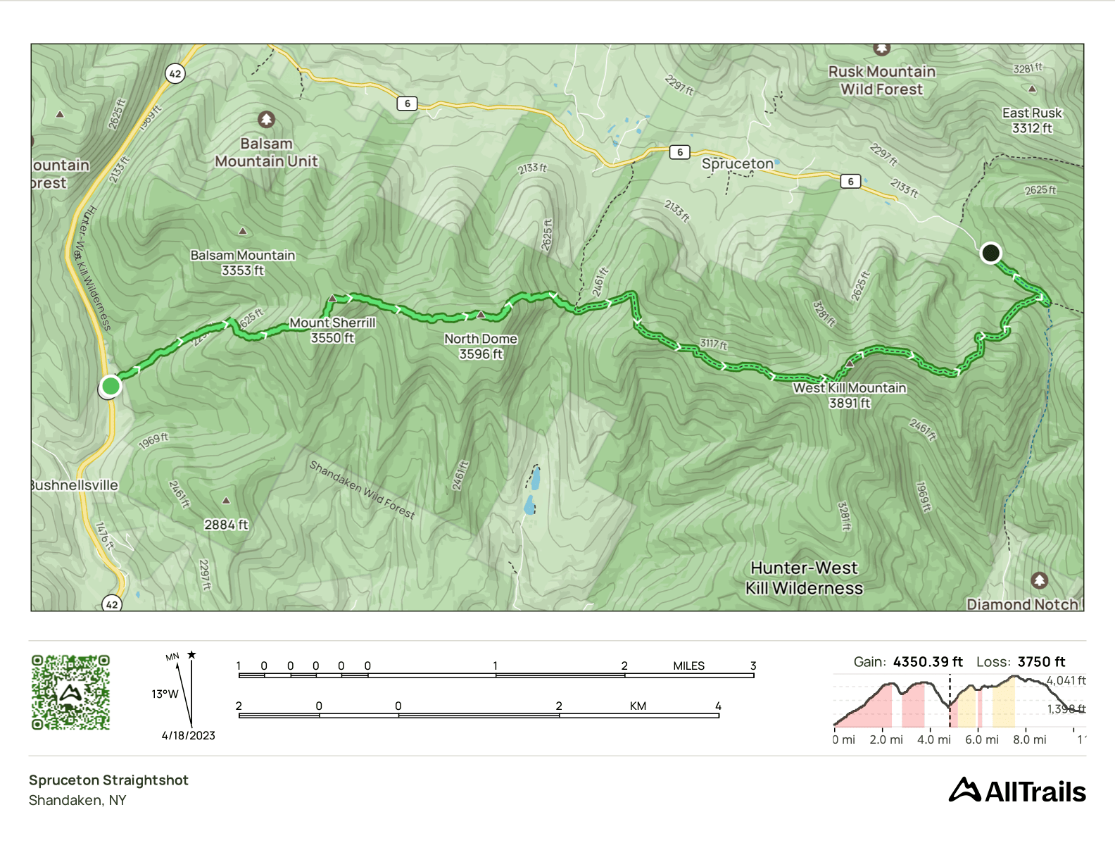
Spruceton Straightshot, a Race Against the Storm
- Peaks: Mount Sherrill, North Dome, Westkill
- Type: Through
- Time: 8 h
- Distance: 11 mi
- Elevation Gain: 4350 ft
- Hikers: Dan, John G
Timeline:
- 9:45 AM Start hiking from Shaft Road lot
- 12:00 PM Summit Mount Sherrill
- 1:10 PM Summit North Dome
- 2:15 PM On the blazed Devil’s Path trail
- 4:05 PM Summit Westkill
- 5:30 PM At Diamond Notch Falls
-
5:45 PM At Westkill parking lot for pickup
- Tracks: AllTrails, eBird 1, eBird 2, eBird 3
- Conditions: mostly hot and a bit buggy; got cooler at elevation and as storms rolled in. Some ice on the east side of Westkill.
I’d been eyeing this weekend in April for Catskills hiking since way back in January when Alex signed up for a yoga retreat in nearby Phoenicia. While I was doing winter hikes in March, I worried that mid-April would still feel like winter on the high peaks. I hadn’t considered that it might feel more like summer! After yesterday’s 90°F hike up Halcott, I was hoping for slightly more wintery weather.
My original plan for this weekend had been to hike Halcott Friday, hike Sherrill and North Dome Saturday, and then to hike Rusk and Westkill Sunday. In retrospect that was crazy, particularly the Sunday twofer. I hiked Rusk a week earlier to take off some of the pressure, but that still left three days of hiking in a row. I was skeptical that I’d be up for Westkill after two solid days of hiking, and it was also unclear whether there would be time for it with Alex’s yoga schedule.
Then, the solution presented itself! In planning hikes over the past few months, I’d noticed that whichever trail I looked at on AllTrails, Sarah Zheng had always hiked it in the past month. Who was this person and why was she hiking so many high peaks? I saw that she posted a track where she hiked Sherrill, North Dome and then Westkill via the Devil’s Path. It came out to about 11 miles. A big day, but definitely doable. It would get me my three peaks with one hike instead of two.
I later learned that this hike even has a name. According to Hikers Anonymous, it’s the “CrazyCombo™ Spruceton Straightshot”. The name refers to the fact that you’re hiking the entire length of Spruceton Road up on the ridgeline. Not quite the tranquil nature vibe I would have gone for in a name, but that’s what it’s called!
I also learned more about Sarah Zheng. There’s a good reason she kept popping up on AllTrails: she was completing a “rolling 420” in which she hiked 35 high peaks each month for 12 months in a row. Crazy!
With all that out of the way, let’s get to the hike!
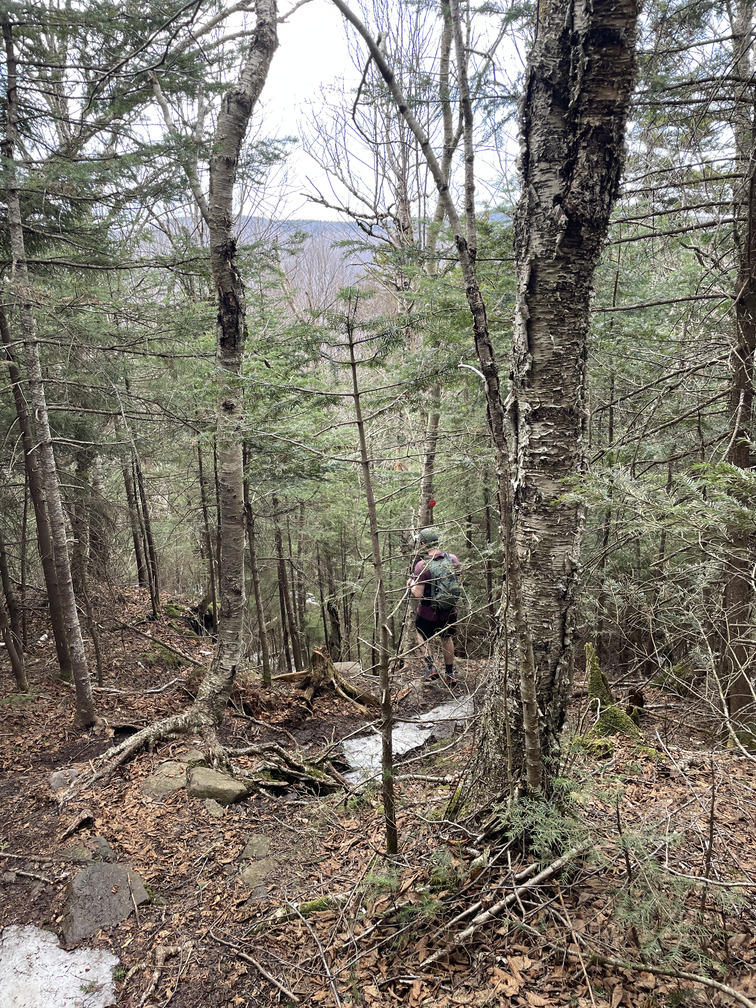
John picked me up from Phoenicia Lodge and we were on the trail at the Shaft Road lot a bit before 10 AM. The trail followed a stream and power line cut. It was very well-defined, clearer than most herd paths.
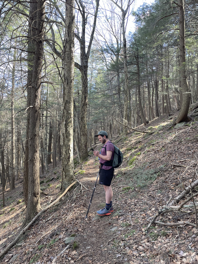
The path was quite steep, so we were very happy to take any excuse for a break. One of these came when we saw a pair of birds rummaging around in the brush near the trail:
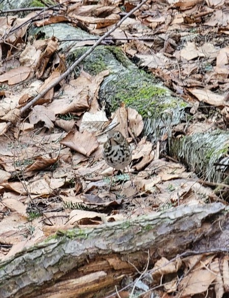
John immediately identified them as Ovenbirds, which would have been exciting as they’d be the first of the season. But eBird said they were rare this early and I thought they might be Hermit Thrushes instead (we even heard thrushes singing in the background, just not this pair). I’d never noticed how similar Ovenbirds and Hermit Thrushes look. I think this is because they’re both birds that you hear 10x more frequently than you see, and their songs are unmistakable. It was the first time I’d had to identify one by sight. We decided they were Hermit Thrushes.
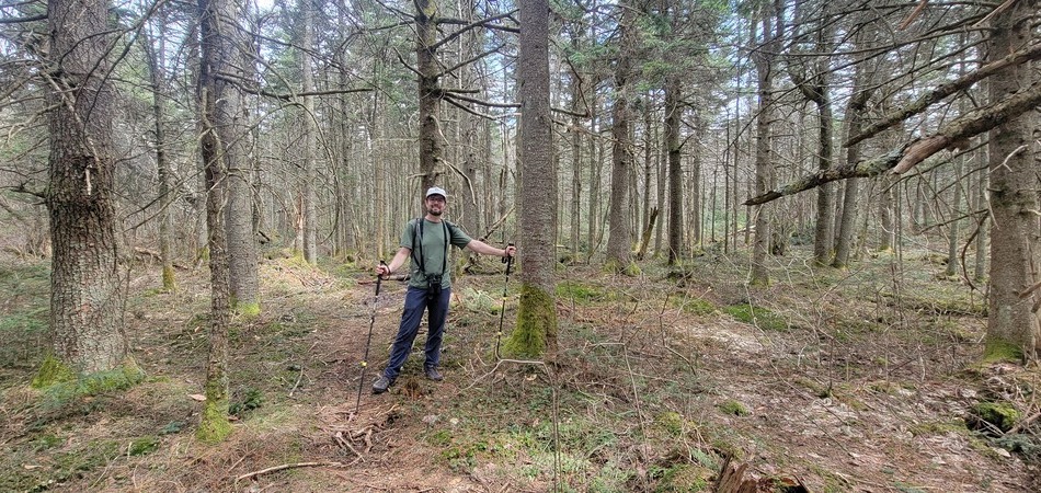
We spent much of the initial ascent in a Hemlock forest. This was cool, pleasant and bug-free. We kept following the trail as the forest transitioned, but soon realized that we should have hitched a right and followed a stream. I’m curious where the trail continued to. Balsam? An alternate path to Sherrill? So began the first bushwhack of the day as we tried to recover the herd path.
This part of the herd path was never quite as clear as the initial bit, but the hiking still wasn’t too bad. We enjoyed some views looking back at the ski slopes on Belleayre from here. They’d clearly been manufacturing snow. We later learned from the owners of the Phoenicia Lodge that today was the last day of the ski season. They’d seen a skier riding the lift in a bathing suit!
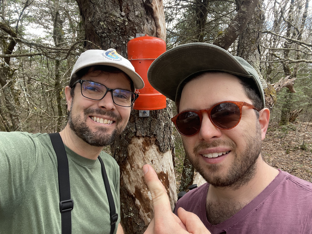
Soon we arrived at the Sherrill canister and ran into three other hikers. John said we were doing the Spruceton Straightshot, and one of them responded that we must be on Hikers Anonymous! They introduced themselves to us by their trail names. John had one from his time hiking the Appalachian Trail (“Sooth Sayer”) but I didn’t. They told us I needed to get a trail name by the end of the hike!
The hike across to North Dome was short and not too steep. It makes good sense that these are typically done as a pair.
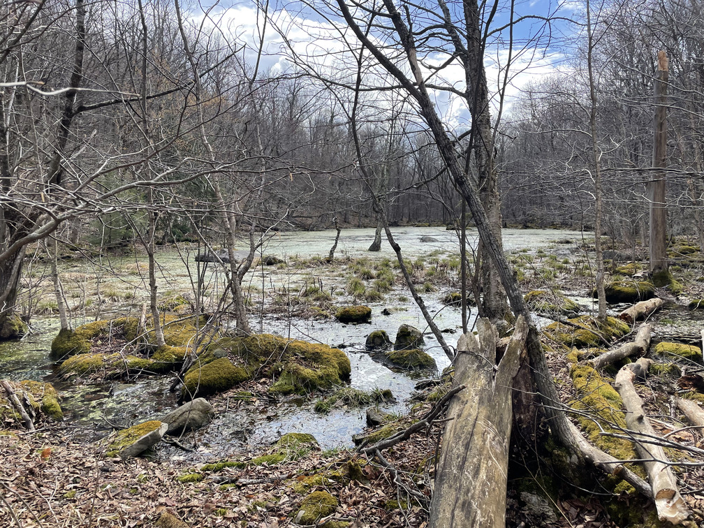
There was a surprising amount of water at high elevation on the approach to North Dome coming from the west. We figured there must be some springs here.
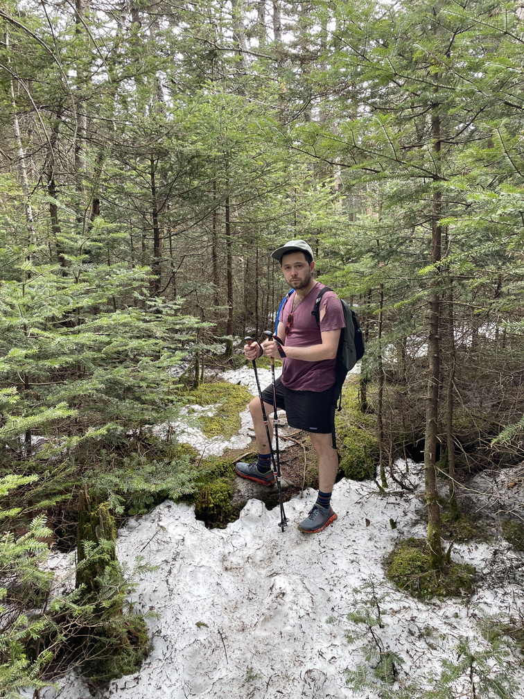
We ran into two guys from Long Island with their dogs at the top of North Dome. They said there were some viewpoints around, but it was already after 1pm and we had a lot of hiking left. We didn’t want to linger. There were a few herd paths from the North Dome canister. We picked the one going in roughly the correct direction and made our way towards the Devil’s Path. We saw our first snow and ice on the east side of North Dome.
I’d read on the NJ/NY Hiking Blog and heard from Lyn, who led the recent 3500 Club Compass workshop, that this section was extremely steep. Lyn had also mentioned that there was a spectacular field of Trilliums here, so I had some hopes that the 90° weather had encouraged some of them to bloom.
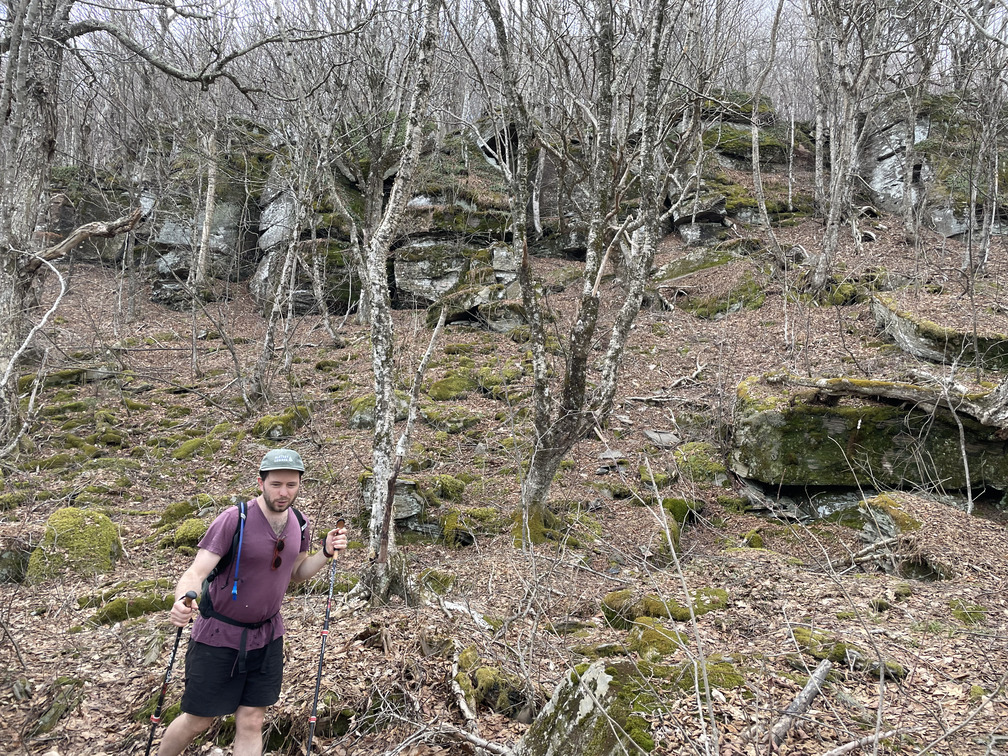
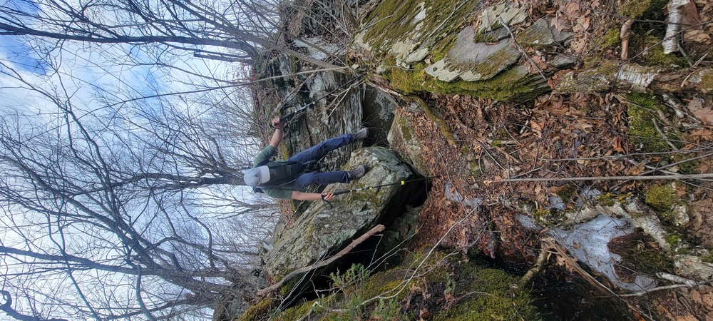
It was, in fact, very steep! We descended something like 1100ft over around 3/4 of a mile. There were at least three rock ledges that we needed to navigate around. This is especially tricky when you’re approaching from above since you can’t tell whether there’s a shear 50ft cliff until you’re right above it. From below, you can see the weaknesses in the cliff more clearly. This may have been the first time in the Catskills that I’ve had to reroute around impassable cliffs. There wasn’t a clear herd path in here, it was more like “choose your own adventure”.
There were lots of Carolina Spring Beauties and Ramps in this area, but we didn’t see the Trillium field that Lyn had mentioned. I’ll have to try for Trilliums in another few weeks.
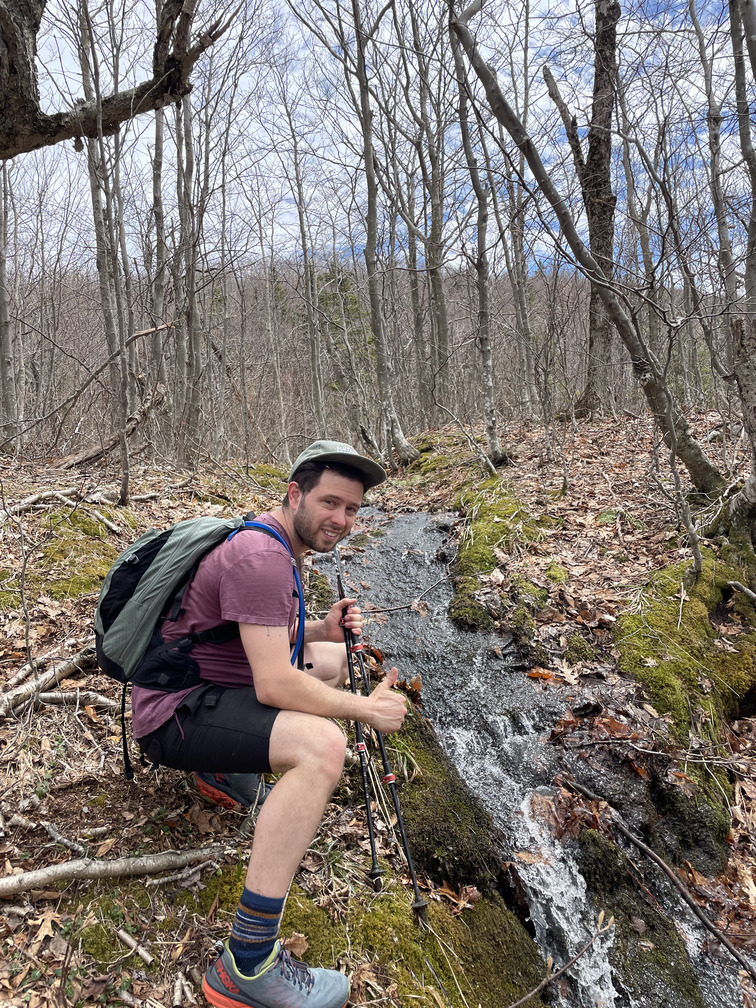
Steep descents are tough on my knees so I was relieved when the terrain started to level out. John spotted water in the distance and I heard wood frogs, so we made our way towards that.
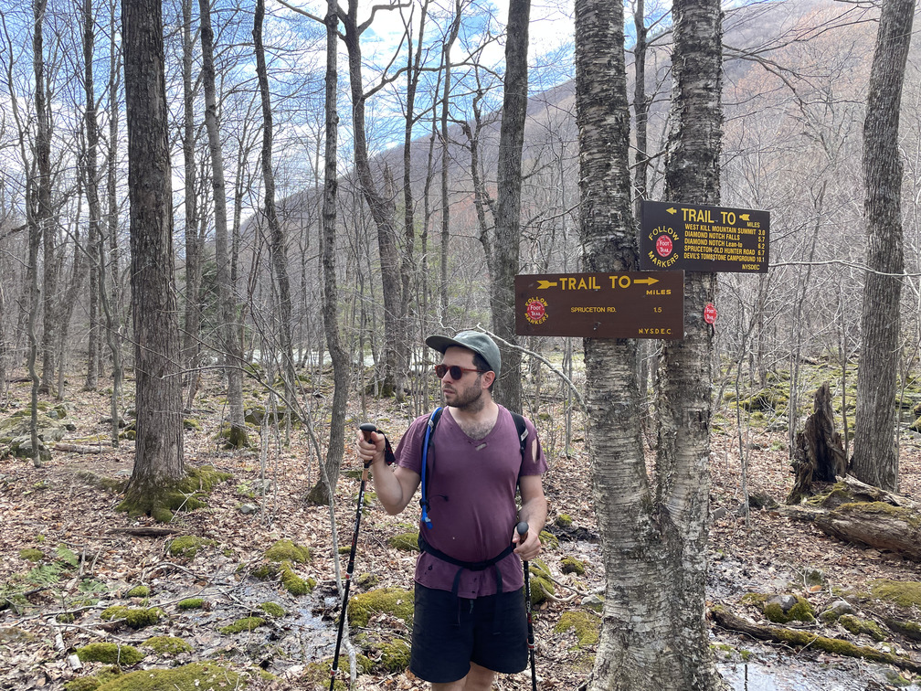
John said he saw the trail. He meant the herd path, but when I looked up I saw a trail sign. The Trail! We’d arrived at the Devil’s Path.
We took a moment to rest and snack before ascending towards St. Anne’s peak. The flies near the pond were bad enough that I put my mosquito netting on. This helped with the flies but made it considerably harder to eat my snack!
It was sunny but there was rain in the afternoon forecast and we could hear thunder in the distance. Time to keep moving! My phone was down to 20% batteries by now, so I put it in airplane mode. The rest of the track is a reconstruction based on the Devil’s Path and photo timestamps.
Despite the benefit of a blazed trail, this section was nearly as steep as the one we’d just descended. After six miles of up and down already, this was the most challenging section of the hike for me. Distant thunder and the threat of rain provided motivation. We had a few drops fall on us here and there, but nothing too bad. We had three trail runners pass us going the opposite direction. They were the only ones we saw on the Devil’s Path. Nine hikers on the unblazed trails, only three on the blazed one. Interesting!
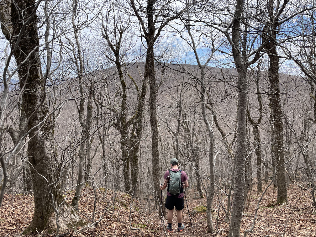
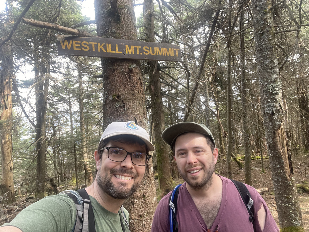
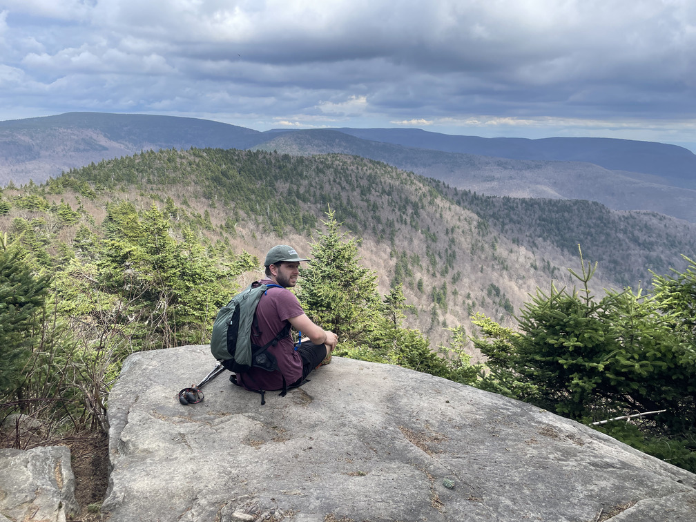
We cruised past St. Anne’s and on towards Westkill. We started to see a bit more snow as we approached the summit (it’s 3900ft vs. 3600ft for North Dome), though never enough to slow us down. Finally we hit the summit!
I’d heard that there was a great lookout just past the summit, so we continued on to that. One of my fears was that the storm would put the Buck Ridge lookout (not the Buck Rogers lookout, as I mistakenly thought!) in a cloud and ruin the view. Not so! We had a grand view of mountains and the thunderstorm that was fast approaching.
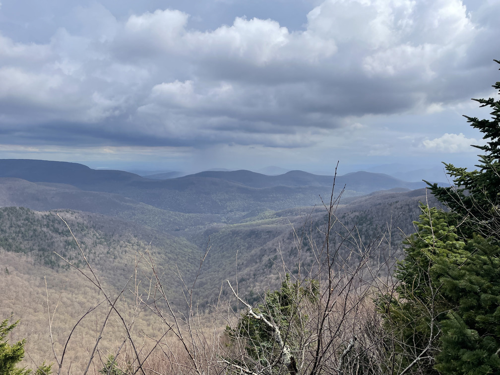
The view was beautiful but it didn’t inspire us to linger. I’d love to come back here in the summer sometime for a picnic.
As with North Dome, there was more snow and ice on the east side of Westkill. It tended to be packed down more on the trail, and it occasionally made for treacherous navigation through the steep sections of our descent. The descent to Diamond Notch Falls was also quite steep: again, something like 1100ft in 3/4 of a mile. My knees were pretty unhappy about this at times and we had to take a few breaks.
Diamond Notch Falls was spectacular, as was the West Kill. I’d love to come back here for a swim sometime in the heat of summer.
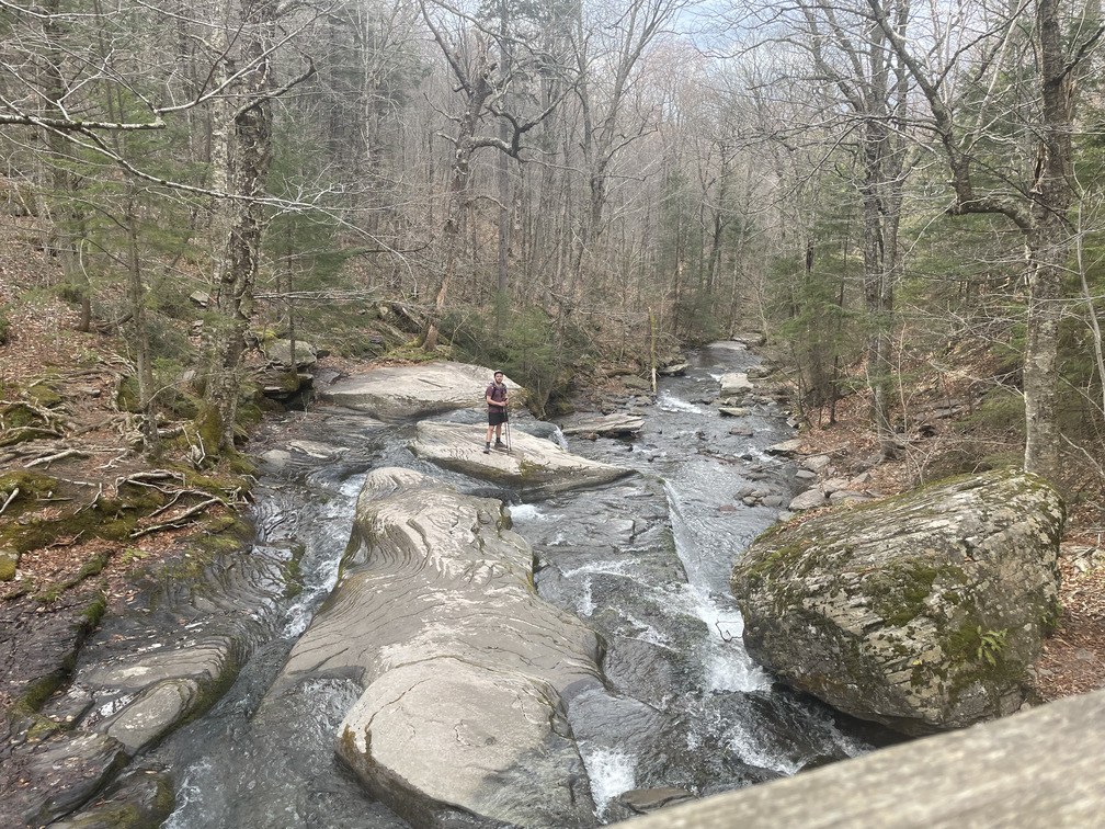
The last mile along the blue-blazed Diamond Notch was a gentle downhill alongside a beautiful river and, after a hard day of hiking, it felt like a victory lap. We arrived at the parking lot right at 5:45PM, our planned pickup time. Sam had just pulled up. Within a few minutes of our hopping in the car, the rain really started. Perfect timing all around!
We had well-deserved beers at Westkill Brewing, but sadly their kitchen had just closed. We got pizza in town and ate dinner at the Phoenicia Lodge instead. John came up with two trail names for me: “Old Ruskie” (after Rusk Mountain) and “Hawkeye” after my affinity for spotting birds. I prefer the latter!
All in all, a tiring but hugely successful day. Just four peaks left!