Panther Meadow from Menla
- Peaks: None
- Type: Loop
- Time: 7 h
- Distance: 8.7 mi
- Elevation Gain: 3100 ft
- Hikers: Dan, John G
Timeline:
- 4/13
- 9:40 AM Start hiking from Menla
- 11:15 AM First plateau; just 500ft from the small “meadow”
- 12:10 PM Summit 2500ft knob, break for lunch
- 1:40 PM Back on the road
- 2:00 PM Back at Menla
- 4/14
- 9:40 AM Start hiking from Menla Yoga Hut
- 10:40 AM Reach first, small “meadow”
- 10:45 AM Reach second, larger “meadow”
- 11:45 AM Back on Menla’s Naga trail
- 12:15 PM Back at the Yoga Hut
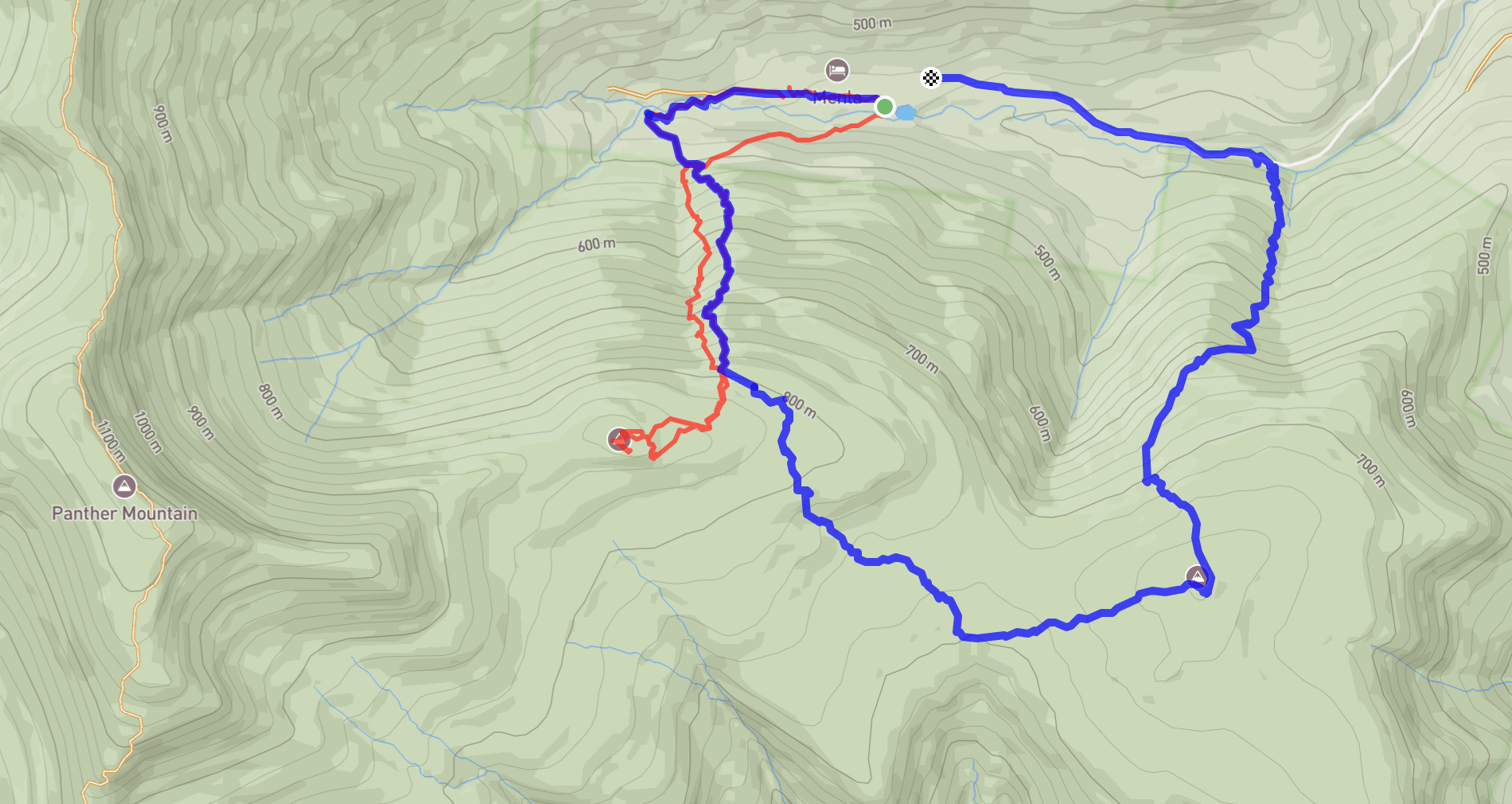
- Tracks: Day 1, Day 2, eBird 1, eBird 2
- Conditions: Wet, cold, rainy, snowy (day 1), beautiful (day 2)
Disclaimer: don’t hike on Menla’s property without first asking their permission!
Last summer, Alex and I did an overnight on Giant Ledge to help survey for New York’s Breeding Bird Atlas. While we were up there, we ran into Jim and Margaret Bouton. Jim told us about a potentially interesting bird habitat in our atlas block: “Panther Meadow,” a ~1 acre glacial meadow that can be seen from the Panther summit. We made a mental note to check it out next spring.
Fast forward to this April, and Alex was attending her annual yoga retreat at Menla, right below Panther Mountain in Phoenicia. Last year I took advantage of this trip to the Catskills and bagged four peaks. This year, as a 3500 Club Member, I felt less pressure to get new peaks. Intead, I wanted to check out this meadow!
As an added bonus, the most direct route to the meadow was from the trails at Menla. With Alex attending a retreat there, I’d be in exactly the right spot. Just like last year, my friend John drove up to join me for the hike.
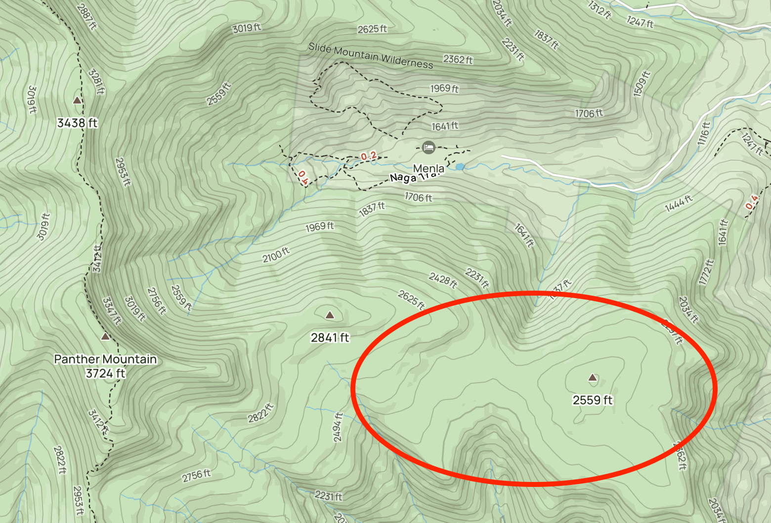
It’s not hard to find information about the Panther meadow online. It helps to know its other name, “Beech Flats.” This is what Michael Kudish calls it in his book. It’s a natural formation due to exceptionally rocky soil. You can even find some pictures online.
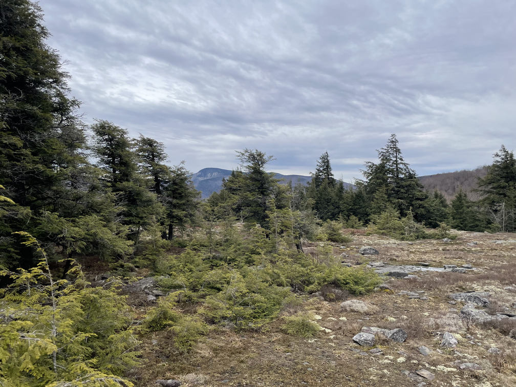
I had a pretty clear sense in my mind of where the “meadow” was. I figured it was somewhere around here:
In fact, I thought it was that entire plateau! As John and I would soon find out, this was entirely wrong. The clearings are relatively small, so it helps to know exactly where you’re going.
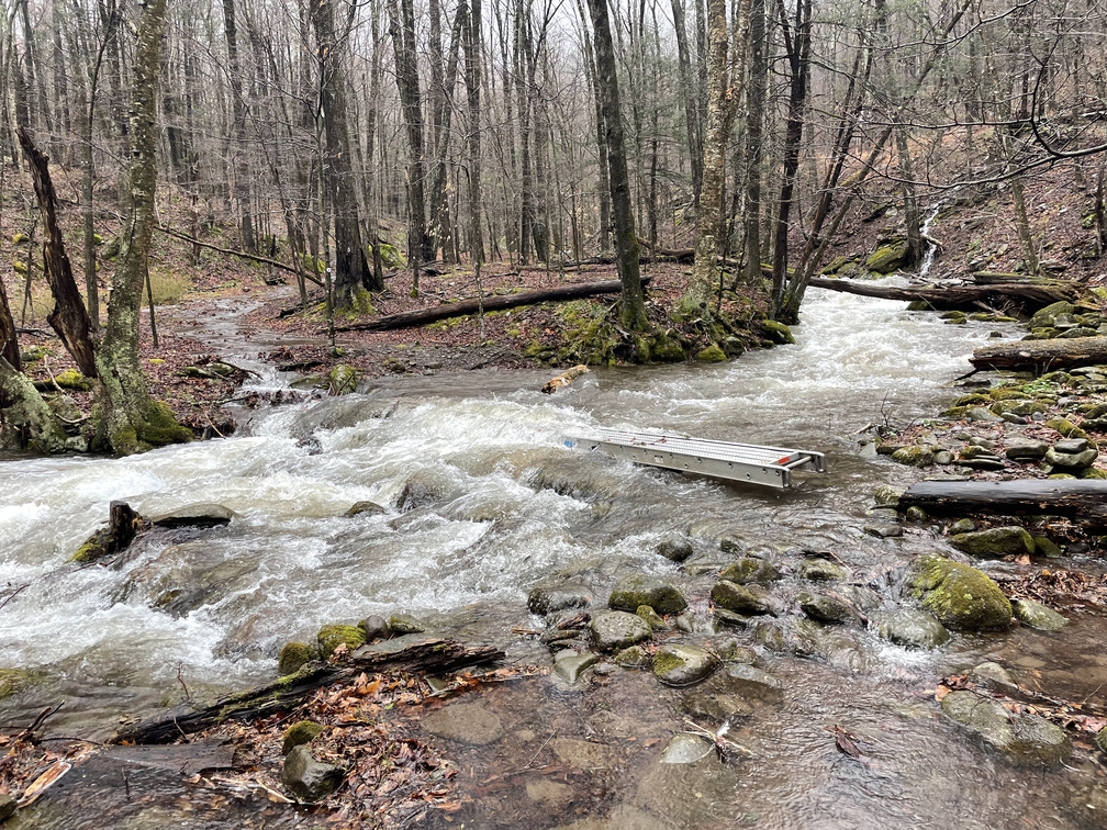
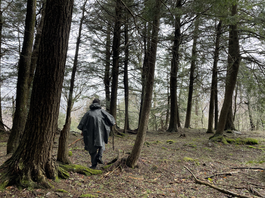
There’d been heavy rain the previous few days, and the Panther Kill was raging. The four river crossing at Menla had been completely impassable the day before. It was lightly raining still as we started our hike, but fortunately the river had subsided enough for at least one bridge to be usable.
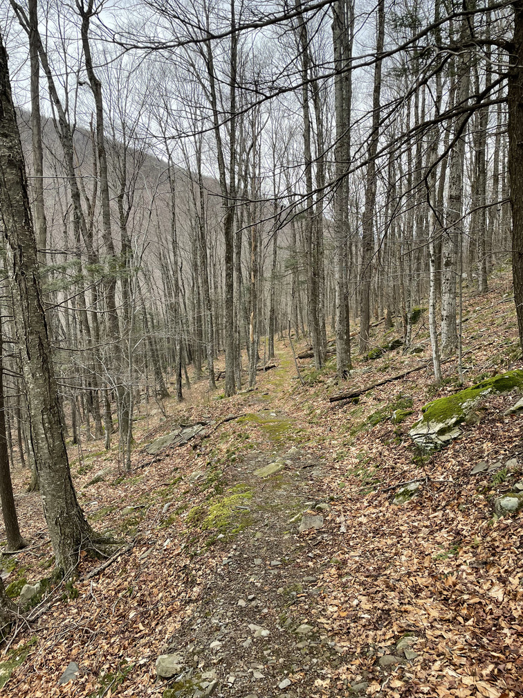
Soon we were at the top of Menla’s “Naga trail” and bushwhacking up the steep slope.
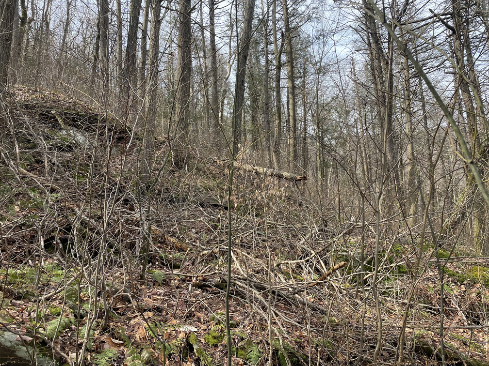
If there was a herd path here, we didn’t find it. Even in mid-April, the brush just off the trail was quite dense and we found ourselves pushing through face-level trees and shrubs. I can only imagine how hard this would be to get through in June or July.
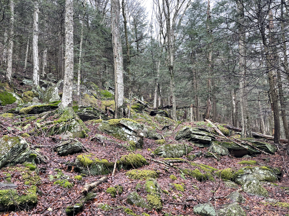
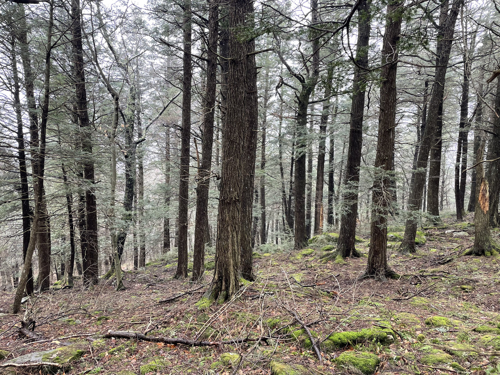
Mercifully, after we gained a few hundred feet of elevation, there was a clearing and the brush got thinner as the soil got rockier. It was still tough hiking, but now it was more because of the slope than the brush. The terrain kept pushing us left of our planned path.
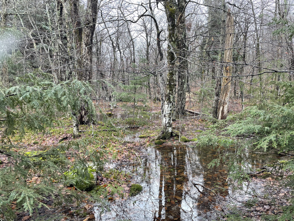
I’d hoped that we’d hit an opening once we reached the summit plateau, but this didn’t happen. Instead, there were tall trees and pools of water. There was also some bear scat, though it didn’t look recent. We weren’t quite sure what to do at this point. Go up to explore the nearby 2800ft knob? Cut across to where I thought the meadow was?
We went down and across, which we later learned was the wrong choice. As it turned out, we were only 500ft from the first meadow!
As we continued our hike, we saw huge Hemlock and Cherry trees. There were lots of trout lilies starting to emerge. We followed a few small rivers as we made our way across a “neck” between the mountains behind us and a plateau ahead of us. It had gotten quite a bit colder by this point and was occasionally snowing. We decided to aim for the 2500ft knob in the middle of the plateau and have lunch. I hoped we’d be able to see the meadow from there.
When we got to the knob, there was a stand of hemlock trees but not much else to see. The trees provided shelter from what was now a raging blizzard. It felt good to eat and drink, but as soon as we stopped moving we started to get very cold. My hands in particular did not like the cold and wet.
We needed a plan. I remembered that you could see a bare spot where the meadow was on satellite imagery. John somehow had one bar of service and was able to load a map. The spot didn’t stand out as clearly as I’d remembered, but it looked like it was way back in the direction we’d come from. We also noticed on my map that Pantherkill Road briefly came over to our side of the Panther kill straight down from where we were. That would save us hiking and avoid the need for a river crossing.
I was pretty much done with the hike by this point, so we decided to head straight down. There were some risks to this decision: we might run into unmarked, impassable streams, and there might be cliffs hiding between the topo lines on my map. But impassable cliffs are rare in the Catskills, so I figured we’d be OK.
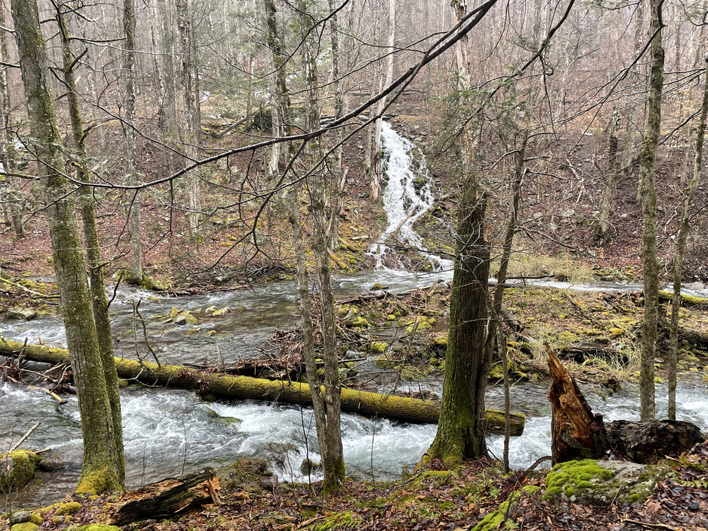
We quickly ran into a wall of Hemlock trees. This was a welcome sight because it provided us shelter from the snow and wind. Once we were in there our spirits improved and the hike started to get more fun. This area was steep and certainly had a few cliffs, but we were always able to navigate around them. We found a clear herd path at one point and followed that down until we lost it again.
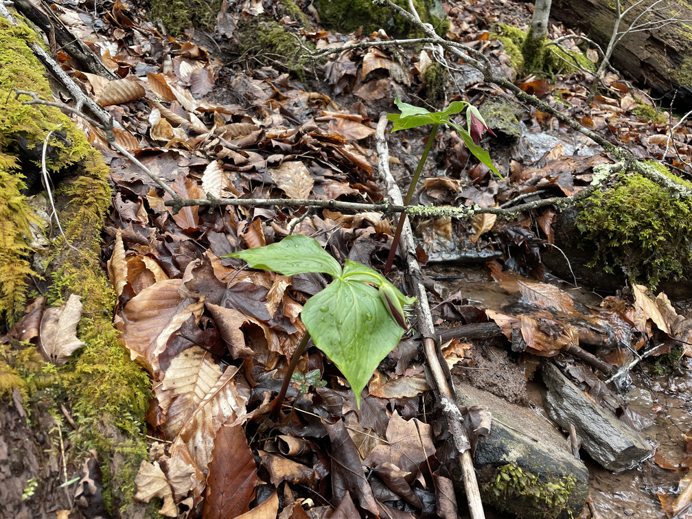
Soon we saw the road, and also some exciting plants!
Trilliums! Fiddleheads! And a tasty seasonal allium. We were a little early for peak trilliums, but John did find at least two that had flowered.
After a quick walk up the road, we met up with Alex for tea at the Menla retreat. That night, I looked up the GPS coordinates for the “meadow” on the blog post that I’d found. Sure enough, we’d been within 500ft of it but turned the wrong way. The forecast for the next day was dramatically better. And now that I’d be hiking on familiar terrain, solo bushwhacking felt less intimidating.
If you’d like to hike to the clearings yourself, here are some coordinates you can use:
- Small Meadow: 42.05817° N, 74.37228° W
- Large Meadow: 42.05793° N, 74.37538° W
We woke up to clear blue skies on Sunday, the first we’d seen in days. My hike on Sunday was a complete contrast to the hike on Saturday: the weather was perfect and everything went smoothly.
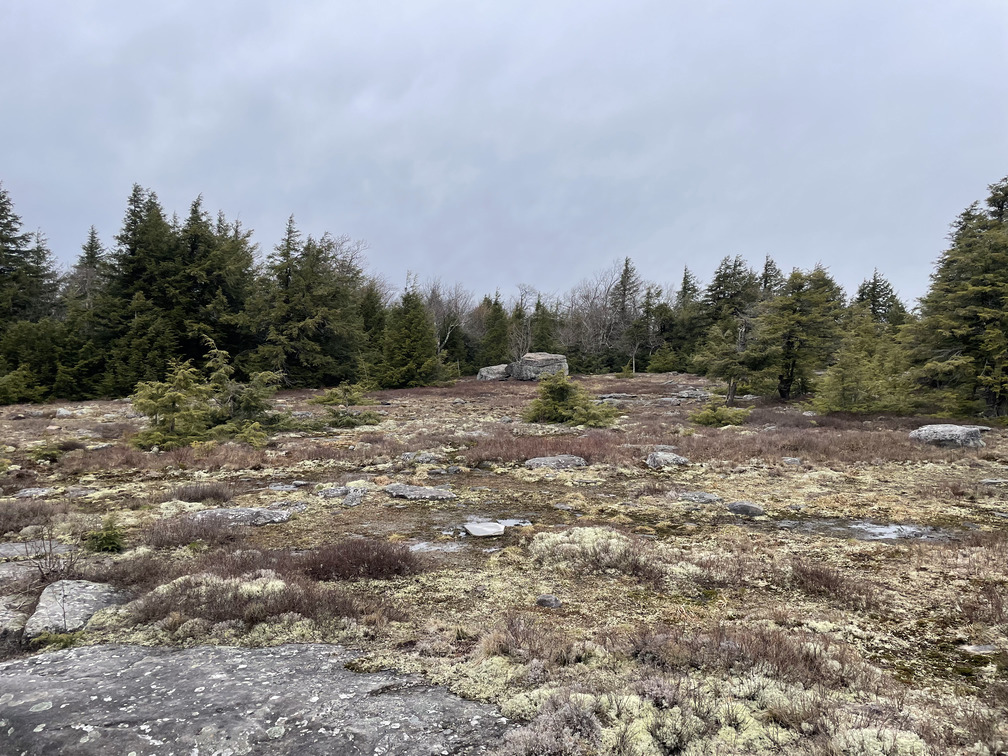
The bushwhack off the Naga trail was, again, hard. I immediately took off my jacket and never put it back on. Once again, I went through some thick brush before it cleared up at higher elevation. When I reached the ponds at the top of the ridge, I went right this time and immediately found the first, small “meadow.”
“Meadow” is really the wrong word. There are no grasses here. “Flats” is better. Here’s what Michael Kudish says about them:
When I first climbed Panther Mountain and looked at the spur projecting to the east, I noted two areas on Beech Flat which were open. Several years later a field trip to investigate these treeless areas was planned, led by Ed West. The open areas were found to be totally natural, with first growth forest surrounding them. Bedrock is exposed at the surface and no glacial till is available for soil formation. This is not unique in the Catskills; there are many others, notably the one on the West Spur of Thomas Cole (a.k.a. Camel’s Hump).
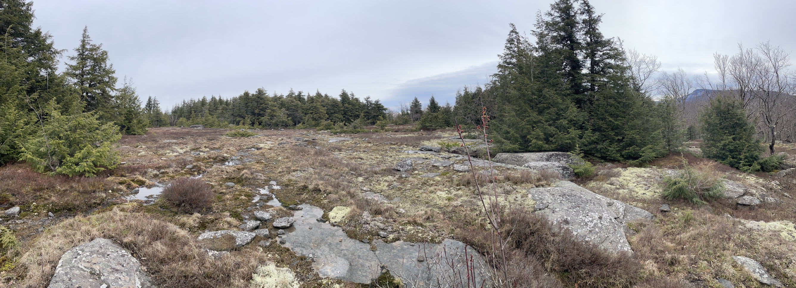
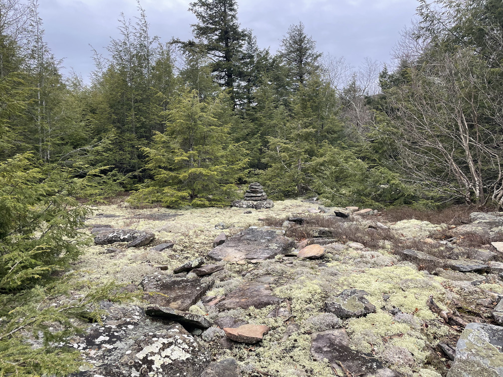
The size of the Beech Flat open areas is about two acres on top of the lower 2740-foot knob, and four to five acres atop the 2848-foot knob. Vegetation, instead of forest, consists of blueberries, clubmosses, mosses, lichens, herbs, and some tree seedlings which will probably not survive.
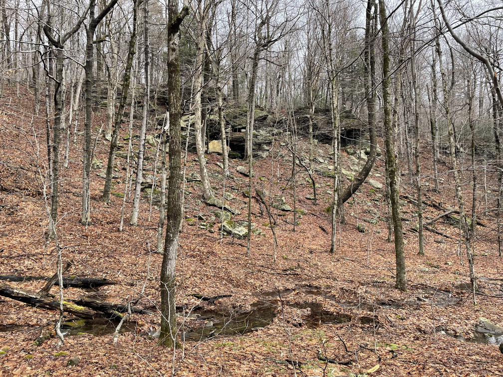
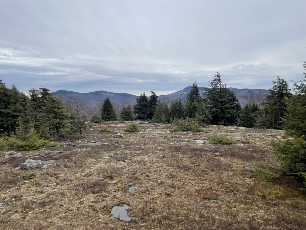
The first clearing was quite small and not much to look at. I’d expected a herd path between the clearings, but there wasn’t one that I could find. There were some more pools between them, and I saw two white-tailed deer running through the woods. I think of them as creatures of the forest edge, but perhaps they’re also drawn to these clearings. Soon I reached some cliffs and, once I crossed them, the larger clearing opened up in front of me.
This one was spectacular. The views were breathtaking and unique. I particularly liked the perspective on Giant Ledge. I don’t know of anywhere else that you can look across and see it at eye level. I confirmed that the clearing is in Alex and my Breeding Bird Atlas block, but I didn’t observe many birds in the few minutes I spent up there. Just some Blue Jays jaying and a handful of Chickadees.
I spent about 15 minute in the clearing before making my way down. Alex’s yoga retreat finished at 12:30 PM and I told her to get worried if I wasn’t back by then. I had a little over an hour to go.
As I walked back from the larger clearing, the cliffs looked much larger than I’d remembered. I opened up my track and, sure enough, I’d drifted too far south. It’s so easy to get disoriented in the woods.
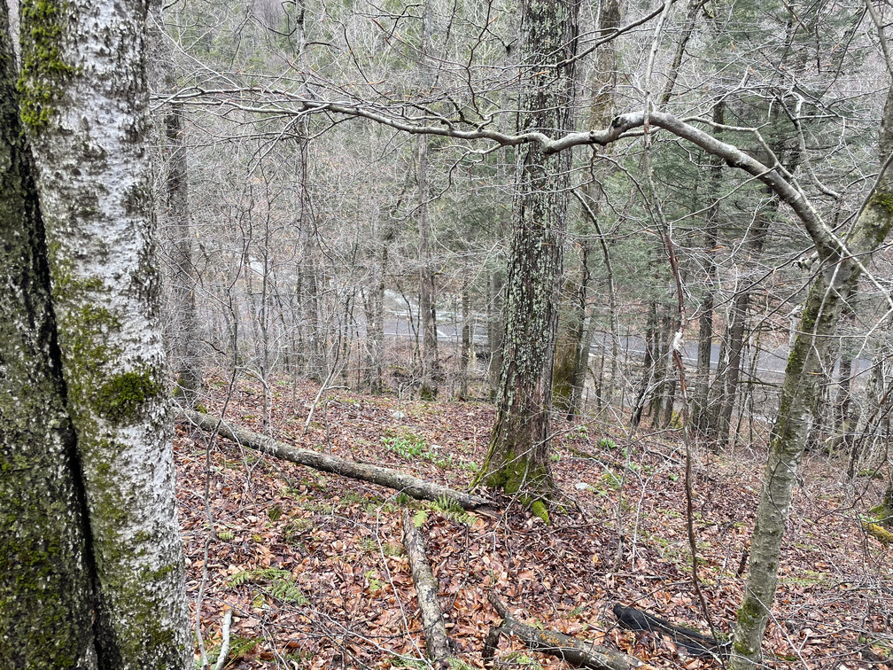
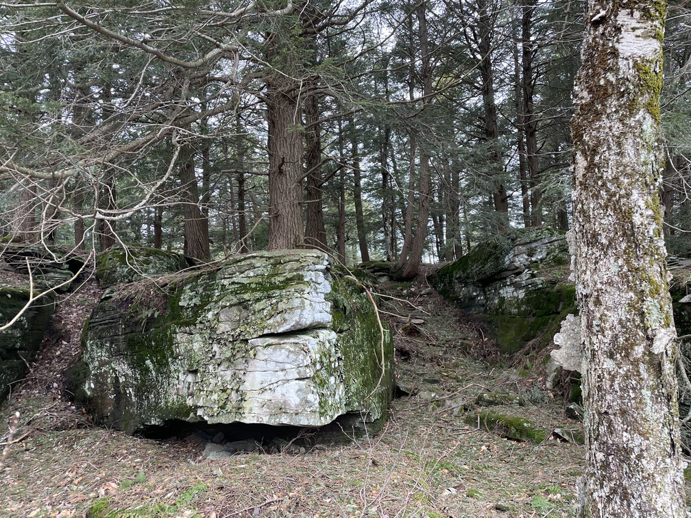
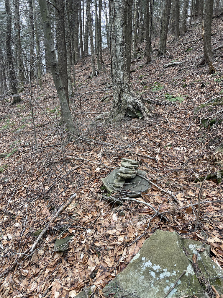
On the way back to Menla, I tried to stay farther west, hoping that I’d find a clearer path. This was somewhat successful. There was an unmarked stream leading down to the Panther kill, and I eventually hugged the banks of that. There were a few areas that felt trail-like here. I eventually found a cairn, so there must have been a trail. I even found a metal mixing bowl!
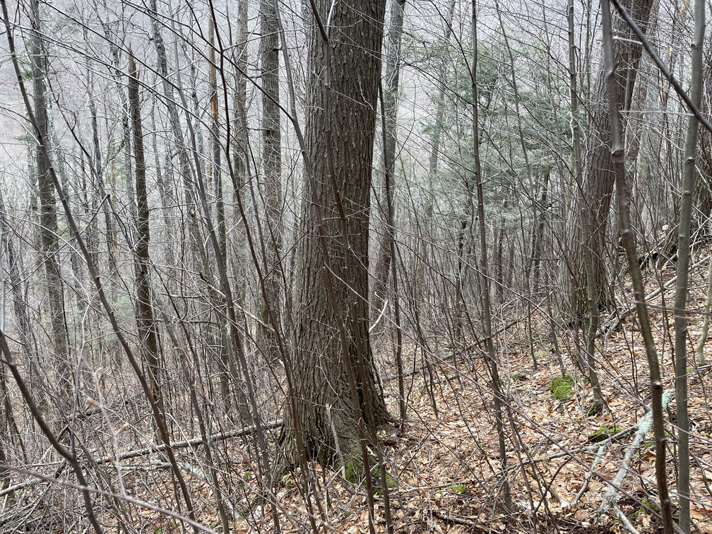
Whatever trail there was has long since grown over. Once I reached the right elevation, I was right back into the brush.
I had some extra time, so I walked the rest of the Naga trail. It’s beautiful! It felt great to be walking on a cleared path.
At the end of the trail I came to one of the Panther kill crossings, at a pond. This had been completely impassable two days earlier, but it looked possibly doable today. There was a pair of hikers on the other side who were clearly debating whether to try and cross. I righted one of the metal bridges that had been dislodged in the torrential conditions and hopped across. My feet got quite wet in the process, but I was so close to the end that it didn’t matter.
The other hikers were curious what path I’d hiked. I always enjoy these conversations where the hike I’ve done is far crazier than they’re expecting. Something similar happened at Halcott last year. They were wearing sneakers so I didn’t recommend the bushwhack!
So the second attempt at this Panther clearing was a big success. I was happy to find it, but is it an interesting bird habitat? I’m doubtful. It would be a great place to camp in the summer, though. I’m sure the stargazing would be spectacular!