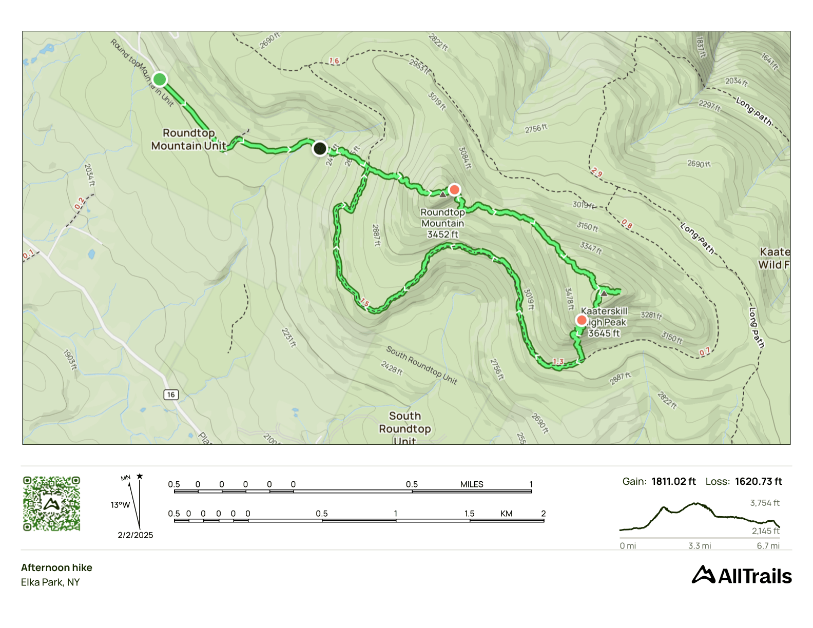
Roundtop/Kaaterskill Adventure
- Peaks: Roundtop, Kaaterskill High Peak
- Type: Loop
- Time: 6 h
- Distance: 7.7 mi
- Elevation Gain: 1700 ft
- Hikers: Dan, Max
Timeline:
- 10:00 AM Start
- 11:55 AM Summit Roundtop
- 1:10 PM Summit Kaaterskill High Peak
- 2:55 PM Start back on Snowmobile Track
-
4:50 PM Back at car
- Tracks: AllTrails
- Conditions: Cold but sunny and calm. A perfect winter day!
My friend Max wanted to do a winter hike and it needed to be on a weekend. I have a Spanish class on Sundays, so it had to be Saturday. Today looked like a good day!
I sent Max my list of peaks and he suggested Cornell and Wittenberg. I’d noticed that my hike planner prefers to bushwhack these from Moon Haw Road, which also gets you Friday mountain. I was curious to try that route, and also to check out a plane crash I’d missed on previous hikes in that area.
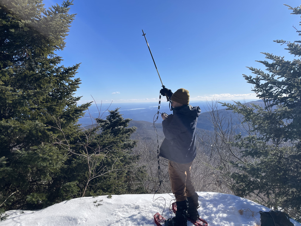
Talking it through the night before, we decided that maybe we should save that hike for the longer days in March. Instead, we decided to do Kaaterskill High Peak. Max had never been before, so it would help him with his 3500 list. He’d recently gotten his ham radio license, and he was keen to get his first Summits on the Air points by connecting with people from 3500+ feet. As a birder, I have a policy of not judging people for their strange hobbies!
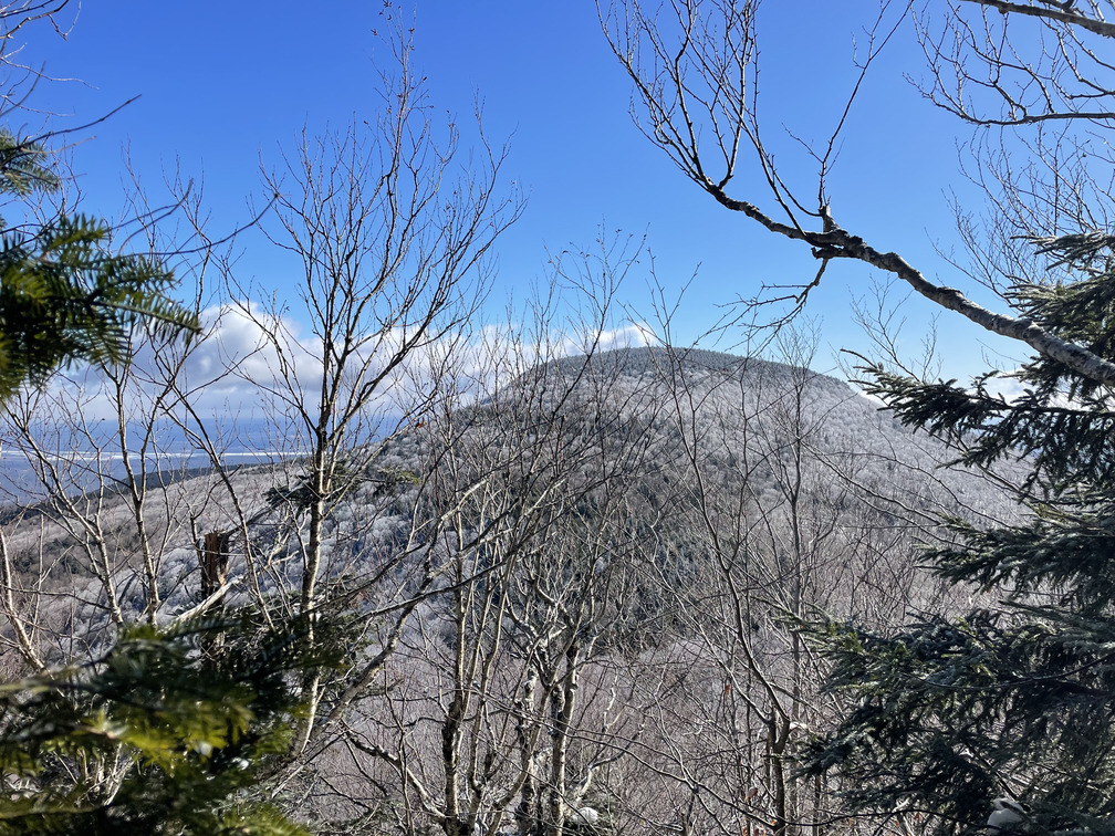
Roundtop is well-separated from Kaaterskill High Peak, but at 3464 ft elevation, it’s just shy of the 3500 foot mark. I had striking views of it on my last hike up KHP, but didn’t have time to make the summit. So Roundtop/Kaaterskill High Peak it was! Our loose plan was to follow a GPX track from Sarah Zheng from 2023.
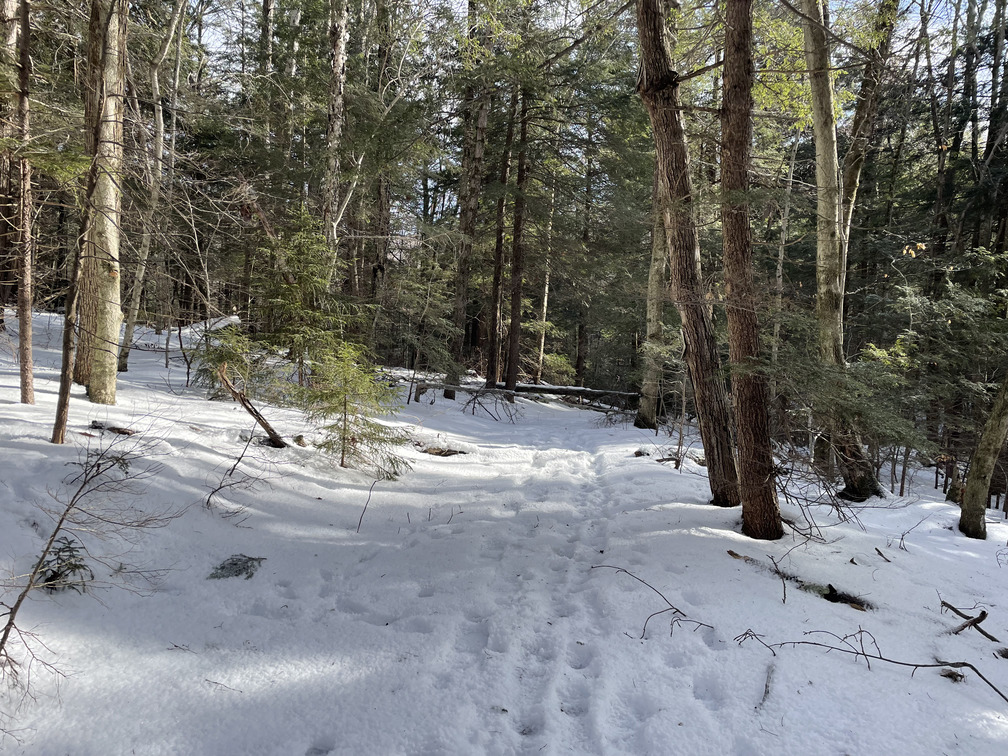
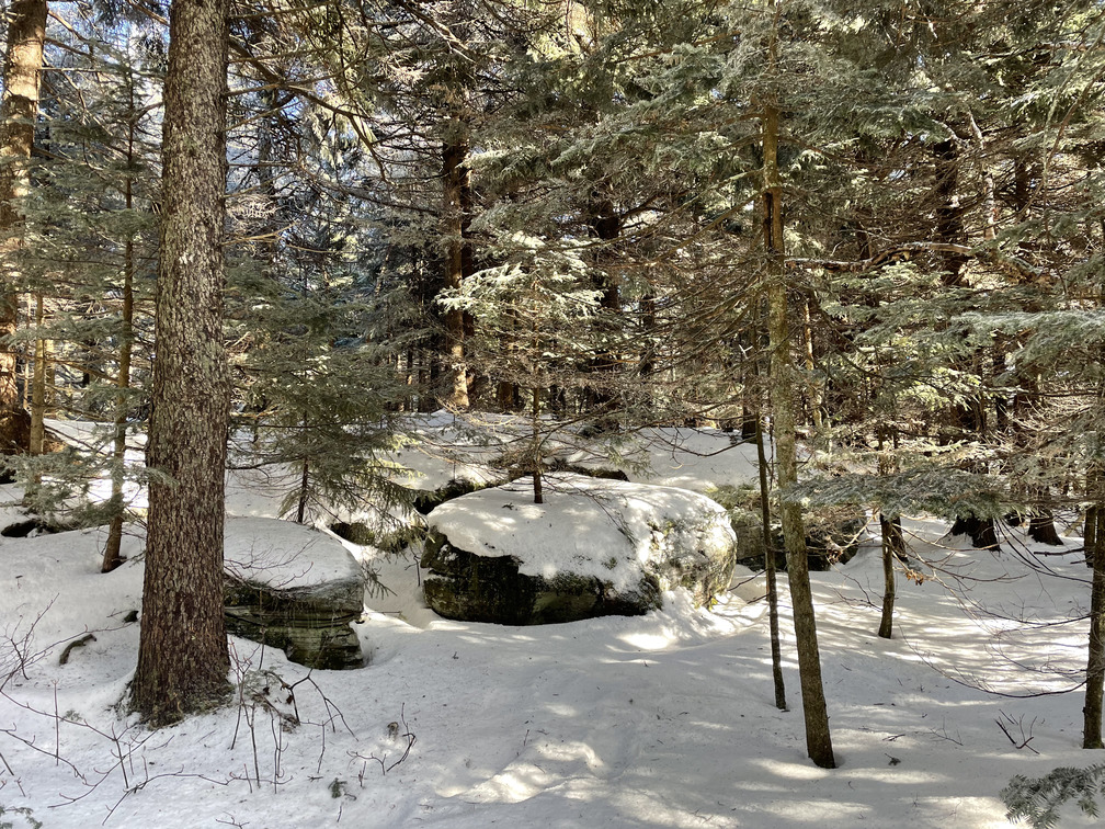
We were the only car at the lot on Gillespie Road as we started the hike. We wore snowshoes from the start and through almost the entire hike. There were clear tracks to follow from the parking lot, but they got less distinct and eventually disappeared entirely as we hiked straight up Roundtop.
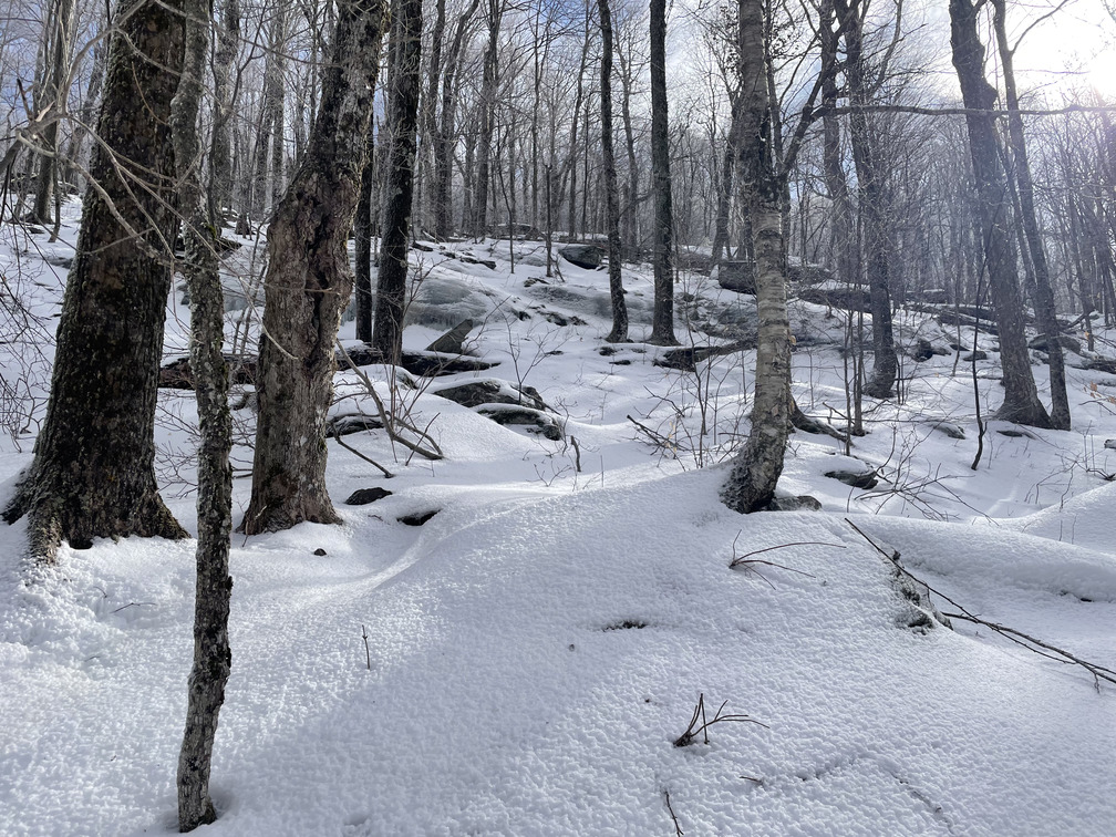
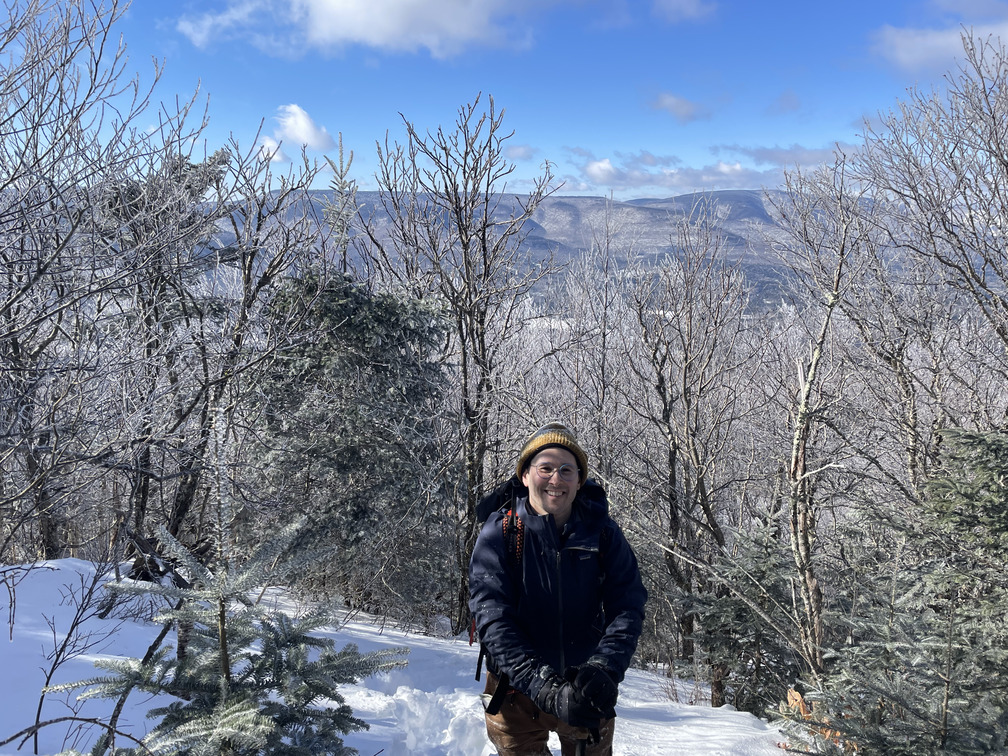
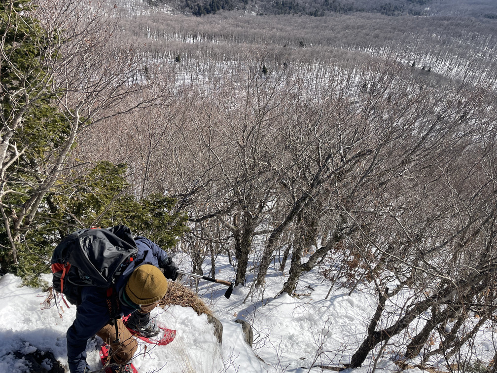
The Roundtop ascent was steep! And somewhat bushwhacky as we never found a clear herd path through here. I’m not sure if there even is one. The view behind us got steadily better as we rose. At one point I turned around to talk to Max and was stunned by what I saw. So many mountain peaks, and we could even see the Hunter ski area in the distance.
We did regain a path as we approached the top, and it took us straight to a cairn which we assume marks the true summit.
From here, Sarah’s track did a loop to get a gentler descent. But we had tracks to follow going straight down, so we followed those. This descent was quite steep but ultimately pretty manageable, and we had great views of Kaaterskill High Peak.
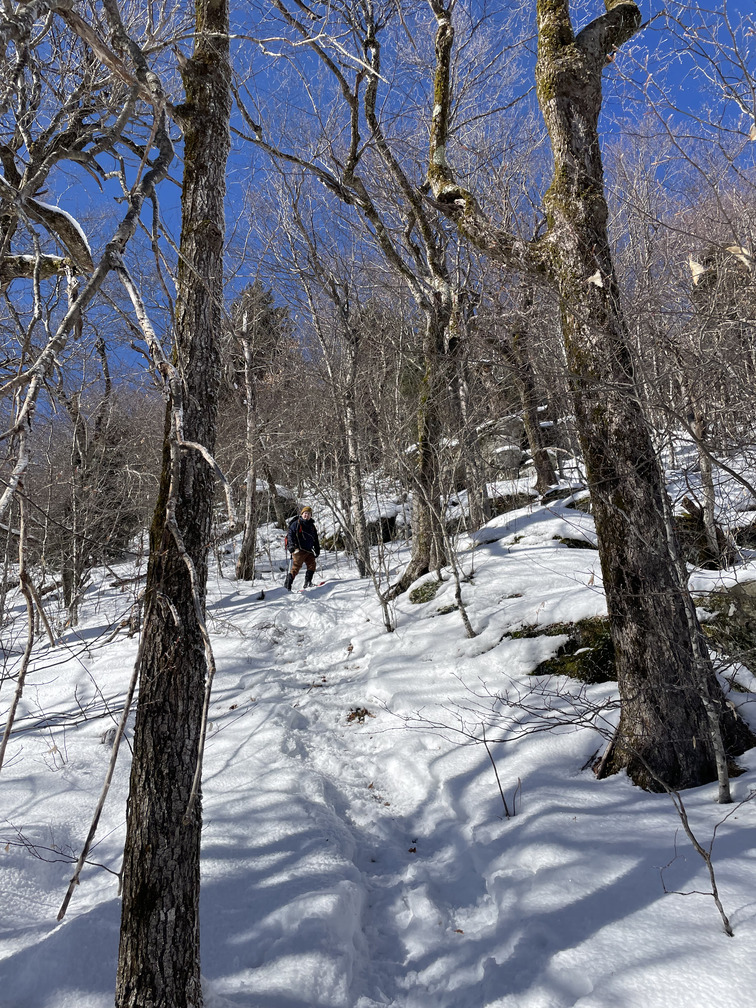
We were able to follow tracks most of the way from Roundtop to the canister at KHP. Hiking along narrow cols between peaks is always one of my favorite things to do, and this one did not disappoint. We had partial views in both directions and a great sense of where we were in space.
Soon we were at the KHP canister. A big group had come earlier that day, so the area was well stamped down and there were lots of tracks leading in different directions. We thought we were making our way down to Hurricane Ledge, but when I looked at the map I realized we’d taken a wrong turn. In retrospect we were very close to a plane crash! I’ll have to mark it on my map for next time.
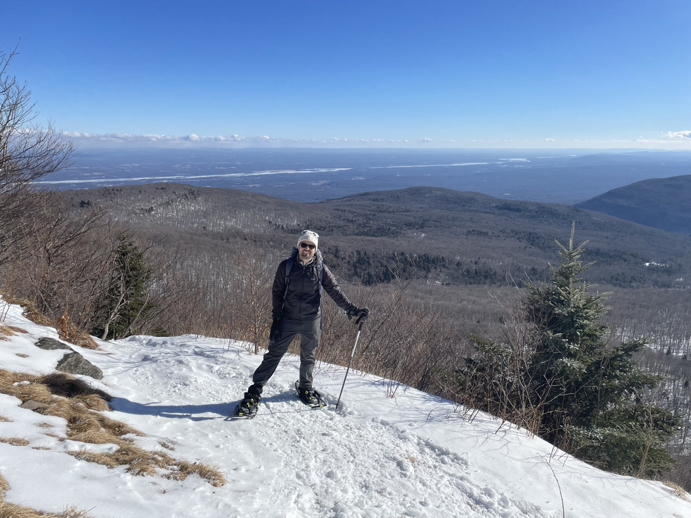
The view from Hurricane Ledge was beautiful. It was cold, but windless and sunny. Basically a perfect winter hiking day! Max set up his radio and made four connections in short order. We ran into another hiker, Rich, who’d recently completed his grid and was doing a winter single season. Max had been concerned about snowmobile noise on the red snowmobile loop down below us. Had he run into any snowmobiles? He’d hiked Kaaterskill at least 15 times and hadn’t seen a snowmobile once!
Since we’d already come down from the summit to Hurricane Ledge and there was a blazed trail, we figured we may as well take it down to the snowmobile path and follow that out. This was a significant deviation from Sarah’s track, but we’d be on blazed trails almost all the way back to the car. This turned out to be a bad decision!
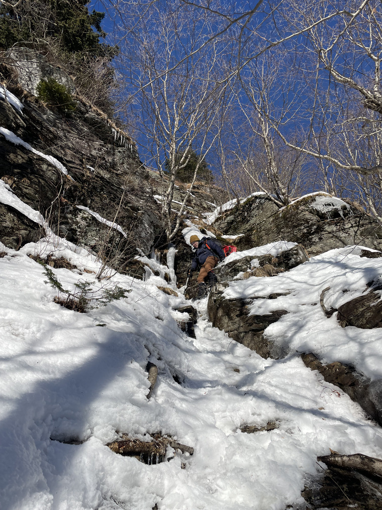
The descent on the “twilight park” trail may be the steepest I’ve ever seen on a blazed trail in the Catskills. It felt almost like I was rock climbing. I had to switch to spikes at one point, the only time I did that all day.
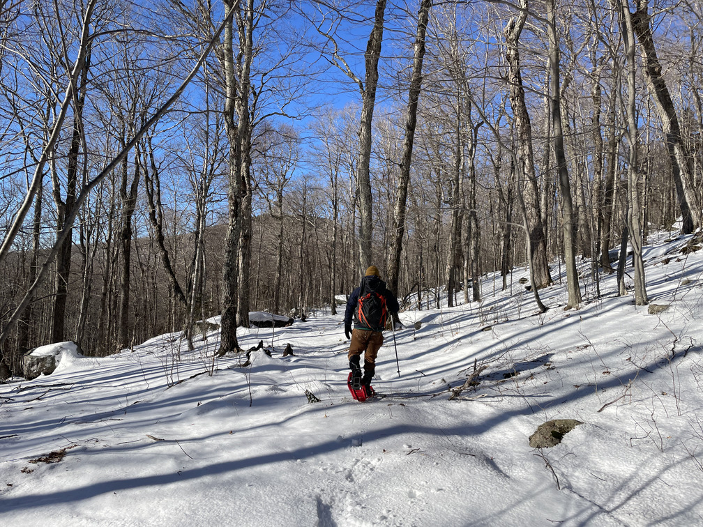
I thought the snowmobile track would be easy, but it was not. While it was blazed, it looked like no one had set foot on it all winter. And it was long. We broke trail for ~3mi all the way back to our tracks from earlier in the day, through snow that was 6-12 inches deep and quite crusty. After some delightful hiking, this part felt like a slog. I felt like we were on a treadmill. Max and I made steady progress and alternated leads, but this part was just long.
It took us about two hours to make it back to our tracks from the morning and then the car. We were done by 4:50 PM, ~25 minutes before sunset.
Three winter peaks down, six to go!