Winter Westkill
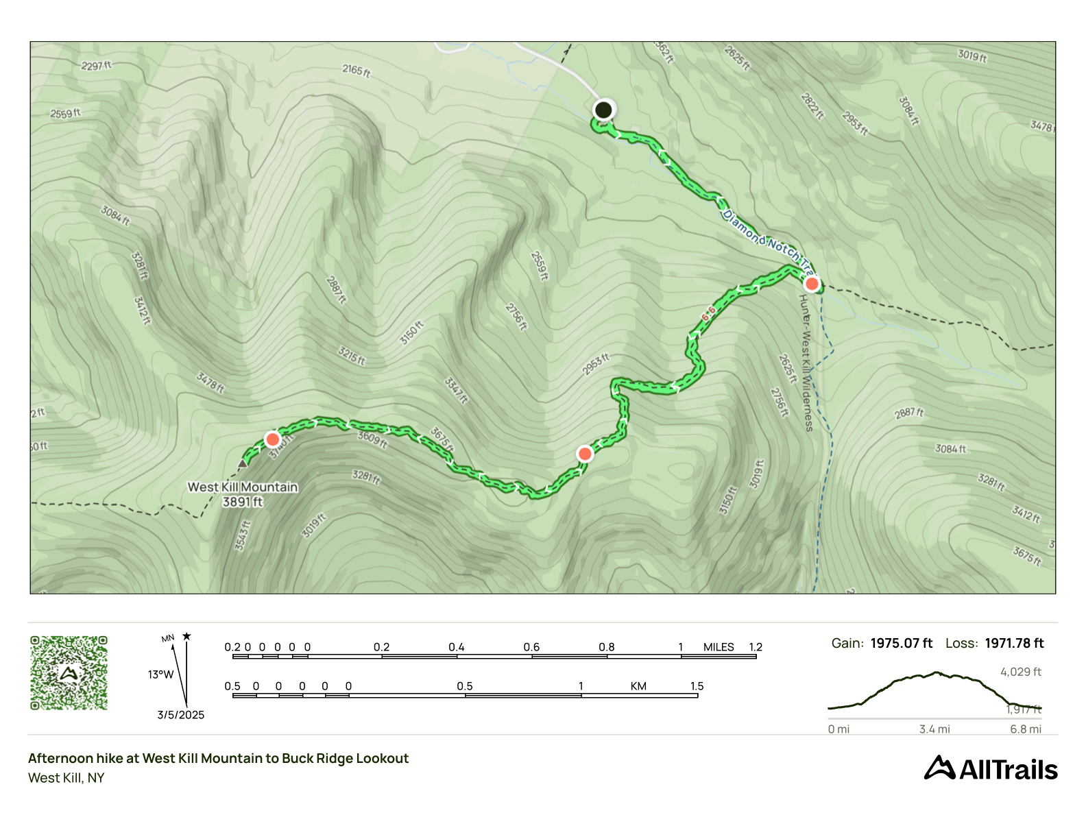
- Peaks: Westkill
- Type: Out and Back
- Time: 3 h
- Distance: 6.7 mi
- Elevation Gain: 2000 ft
- Hikers: Dan
Timeline:
- 11:00 AM Start
- 12:30 PM Summit Westkill
-
1:50 PM Back at car
- Tracks: AllTrails
- Conditions: 40s at base, 30s at summit, some flurries on the way down. Strong track all the way up, 2-2.5 feet of snow at the summit.
With just two hikes left to complete my winter peaks, which one would be the last? John G and I had a chat yesterday that clarified things. He was available next Sunday and was interested in seeing the crashed airplane below Friday Mountain. So my last hike will be Cornell and Wittenberg. That meant I needed to knock out West Kill sometime this week.
There was heavy rain in the forecast for Wednesday, my usual hiking day, so I shuffled things around to go hiking on Tuesday. I’ve tried to do something different for each of my winter peaks this season: adding Roundtop to KHP, adding Sleeping Lion to Halcott, checking out the viewpoints on North Dome and Sherrill. It’s possible to hike to Westkill from the south, and I’d been eyeing this ridge on the map for a possible bushwhack:
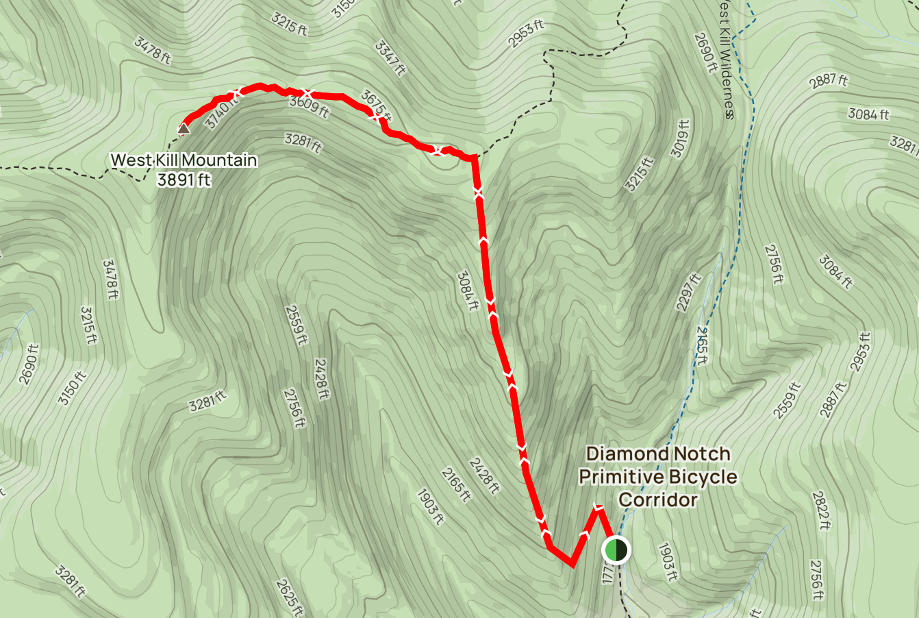
But given the time and the fact that I’d be doing this hike solo, I thought it would be better to do a “surgical strike,” a quick, conventional hike to get my winter peak. In the end, at 2h50m, I think this may have been the fastest Catskills hike I’ve ever done!
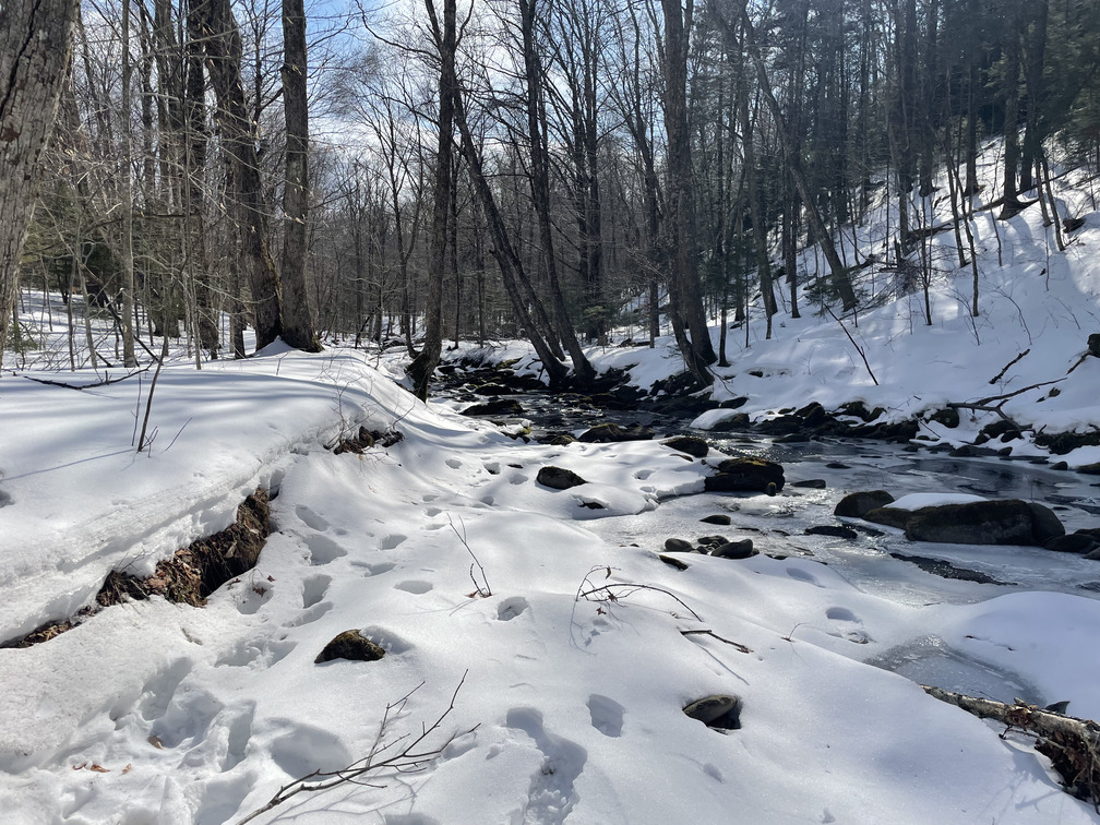
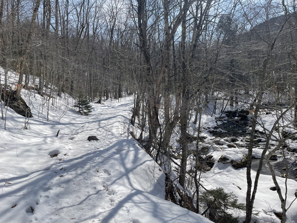
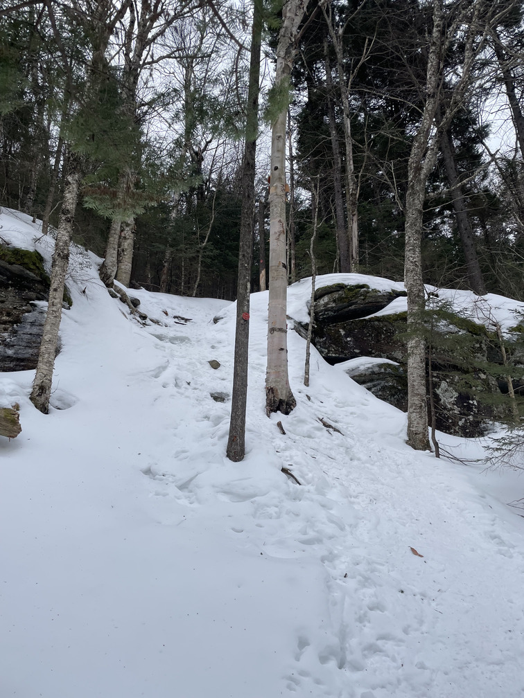
There were a few other cars in the lot when I arrived. It was quite icy, so I started in spikes. I followed some footprints down to the stream, then realized this was a mistake as they went onto the stream. It was in the 40s at the base today, and I had no interest in doing that. I made my way back up to the road and was quickly on the blue trail.
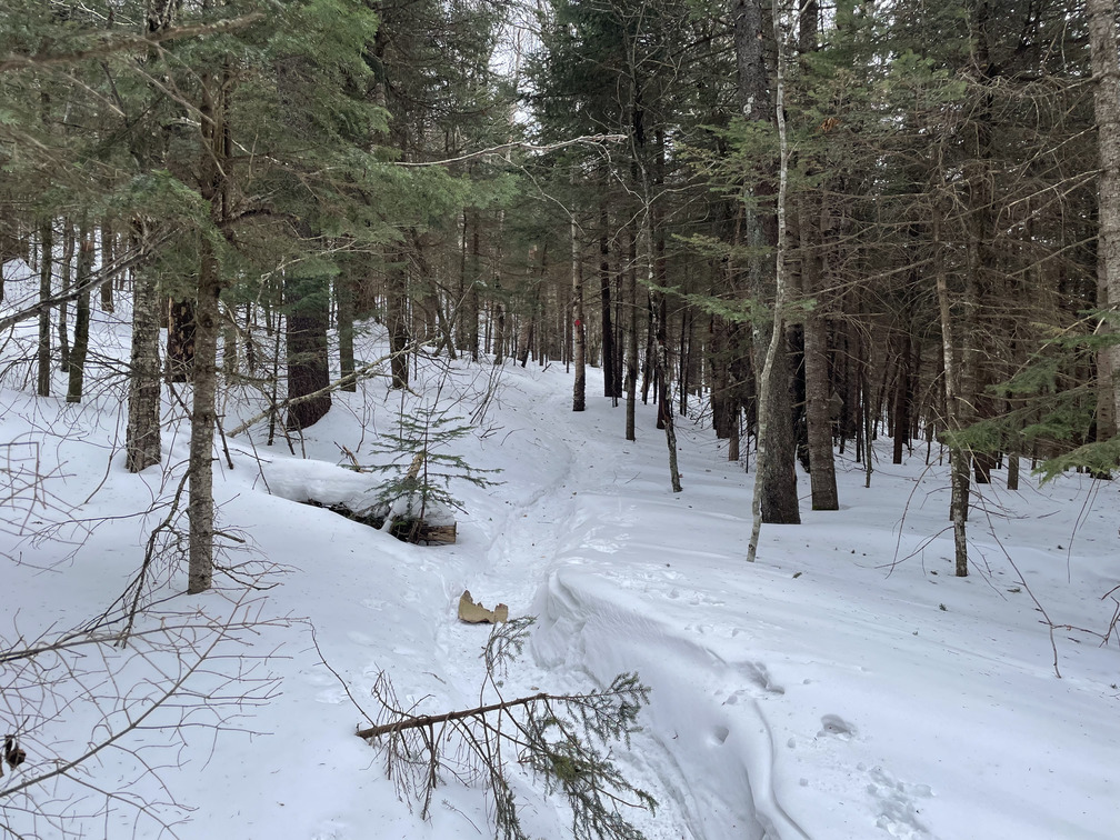
It was quite icy and, after many hikes in snowshoes this winter, it felt novel to be hiking on terrain where spikes were perfectly appropriate. I brought my snowshoes with me, but thanks to a well-beaten path and lots of ice, I never took them out of my bag.
It was sunny, and within 30 minutes I was down to my T-shirt. A “spikes and a T-shirt” kind of day! I got quite warm on the steep ascent. I was happy in my T-shirt, and probably would have even been happy in shorts!
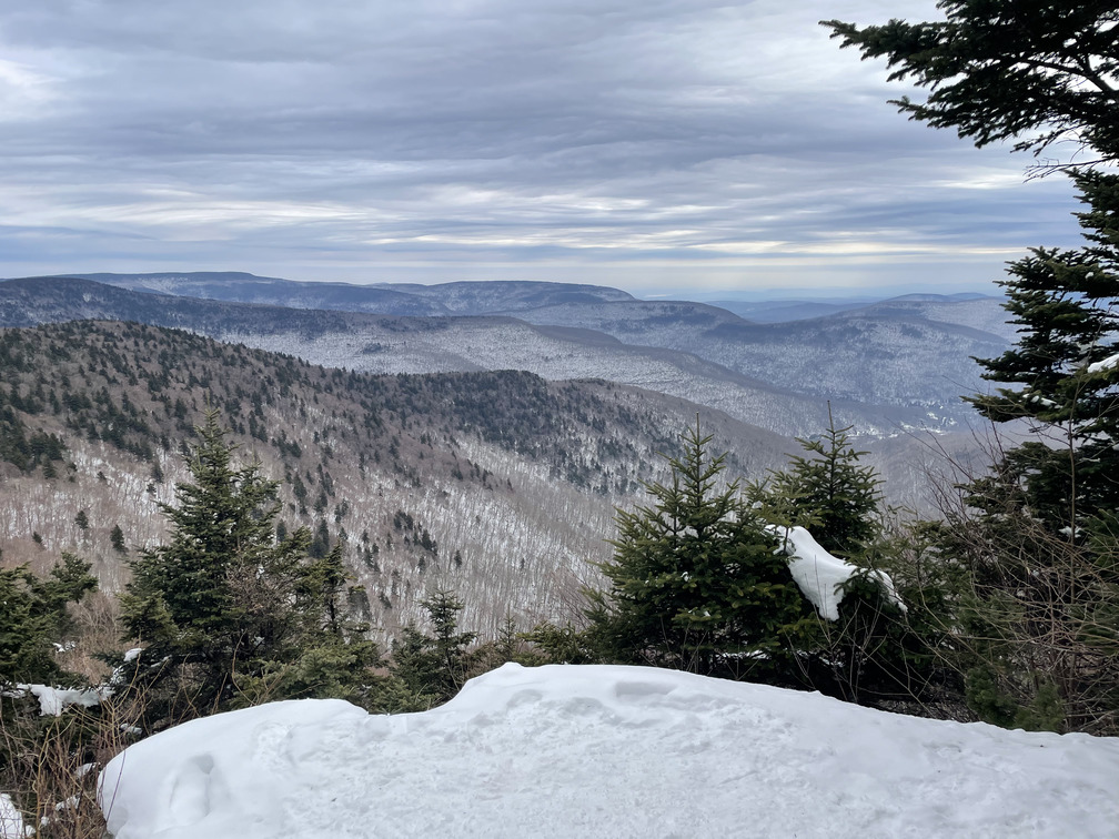
As I got to elevation, I kept thinking the lookout was just around the corner and I’d put my jacket back on there. It turns out to be about a mile from the 3500ft marker to the Buck Ridge lookout, so I was in my T-shirt for probably a bit longer than was wise. I ran into two other hikers heading down here. They were the only ones I’d see all day.
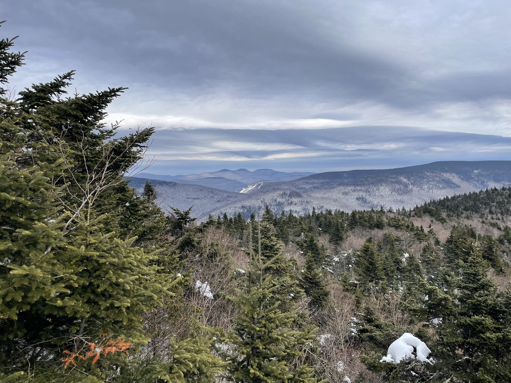
Soon enough I was at the famous Buck Ridge lookout!
I put my jacket back on and noticed that my arms were a bit stiff from the cold. I dropped my pack and made a quick dash over to the true summit. I noticed a Hairy Woodpecker right below the viewpoint.
To try and avoid impact on my knees on the descent, I used two poles for the hike down. This may have helped reduce impact, but it did have the disadvantage that both your hands have to be out of your jacket, which means they get cold. (I wasn’t use hand warmers today.)
Pretty soon that was not a concern — I got quite warm on the way down, too! The incline leant itself to half-jogging. I made very good time through here. My knees did eventually start to hurt. Based on my description, Alex thinks it’s an IT band issue.
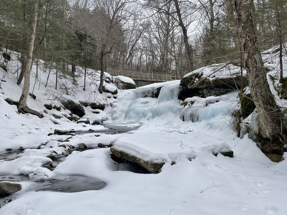
The waterfall at the bottom was a spectacular, glacial blue.
I ran into the other hikers in the parking lot again. They were both “working on their grid” and complimented me on choosing Wittenberg for my final winter peak.
I’ve learned this season that the one flaw with Wednesday hiking is that it’s the only day of the week that the Phoenicia Diner is closed. But today was Tuesday! So I stopped in for a victory milkshake on my way back.
When Alex and I did this exact hike last fall, I wrote that it was the first time I’d felt genuine cold in months. Five months later, it’s been a very cold winter and I’m looking forward to the spring. But not until I finish my winter peaks. Hopefully next weekend!