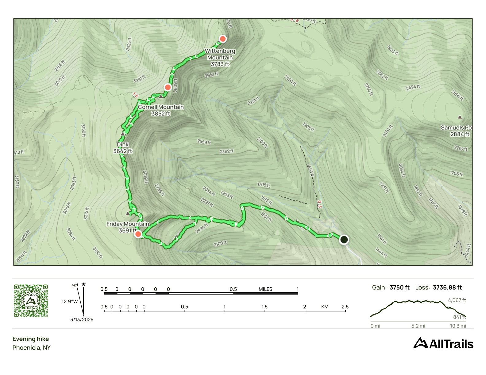
Friday, Cornell and Wittenberg
- Peaks: Friday, Cornell, Wittenberg
- Type: Out and Back
- Time: 8 h
- Distance: 10 mi
- Elevation Gain: 3750 ft
- Hikers: Dan, John G
Timeline:
- 10:00 AM Start hiking from Moon Haw lot
- 11:50 AM Summit Friday
- 1:30 PM Summit Cornell
- 2:00 PM Summit Wittenberg
- 5:00 PM Arrive at B-25 wreck
-
6:00 PM Back at car
- Tracks: AllTrails
- Conditions: Bare soil at the base, ice on the way up to Friday, deeper snow off-trail between Friday and Cornell. Temps in the 20s, partly cloudy. Lots of ice on the trails!
Today was the day! After three seasons of winter hiking, I was down to my last two peaks: Cornell and Wittenberg. These are typically hiked via the blazed trail from Woodland Valley. But my hike planner app always suggests approaching them from Moon Haw Road because it’s less mileage, even if it’s more elevation and tougher terrain. Still, I was curious to try this route and also to check out the B-25 wreckage that I’d missed on my last hike here two seasons ago.
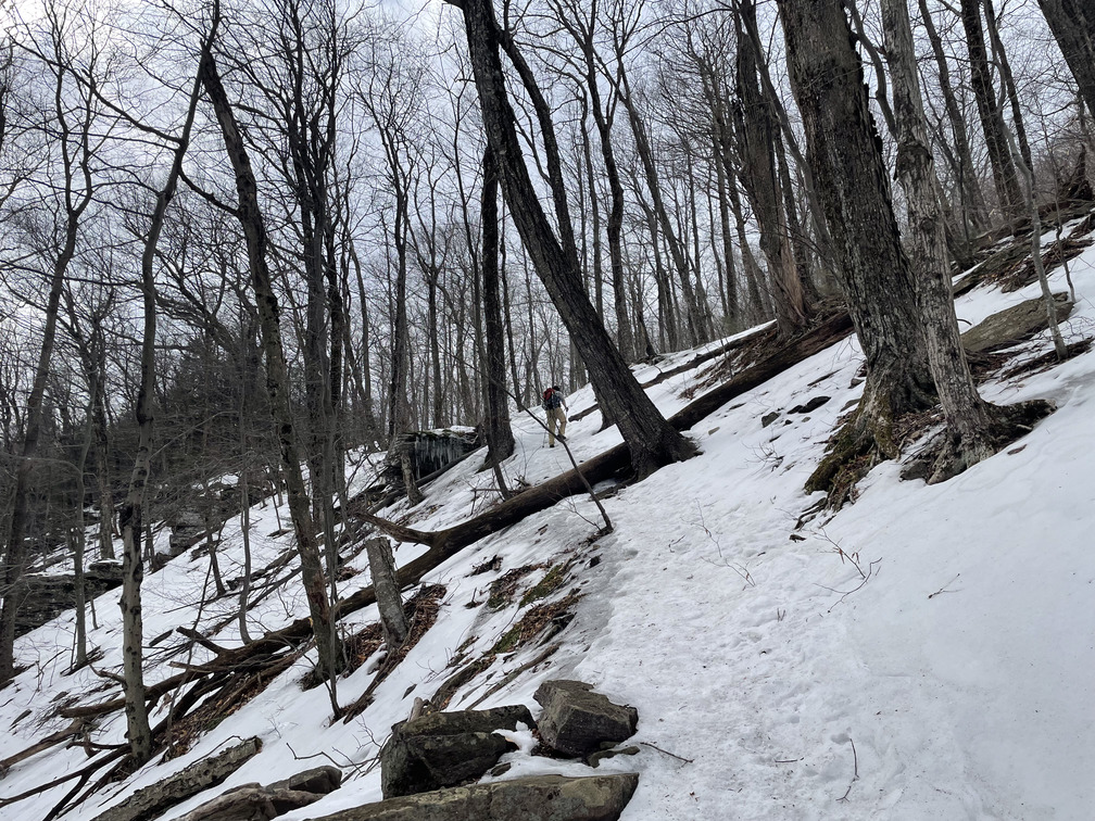
John G came over to my house for breakfast and we drove up to the Moon Haw Road lot. There were quite a few cars there when we arrived. One of them was a Rip Van Winkle Guides van, so there was clearly a group. The beginning of the hike is on old logging roads. While these aren’t blazed, they’re clear as could be. This hike begins at lower elevation than most, and the first quarter mile was on bare soil. After two months of hiking on snow and ice, it felt strange to be hiking on dirt!

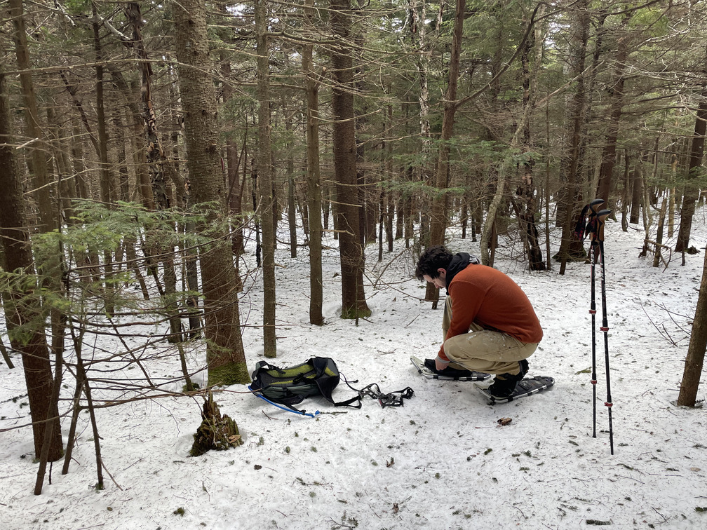
Within about a quarter mile the trail started to have patches of ice, and soon we were walking on pure ice. We were very grateful for our microspikes! We had nice views of Cornell and Wittenberg here. The ascent was long and steep, but I felt like it went relatively quickly. John might not agree! This was his first Catskills hike since last summer. I don’t bring him on the easy ones!
We caught up with the Rip Van Winkle group on the “ramp” below the summits and passed them one by one. After the last person, we wanted to get some distance and I hiked quickly. After a few minutes, John said that we’d “achieved escape velocity” and we took a breather. It really felt like the group sped up behind us once we passed. They were hot on our heels all the way to the summit. John found this was good motivation to keep moving.
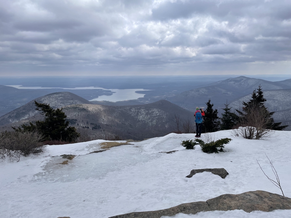
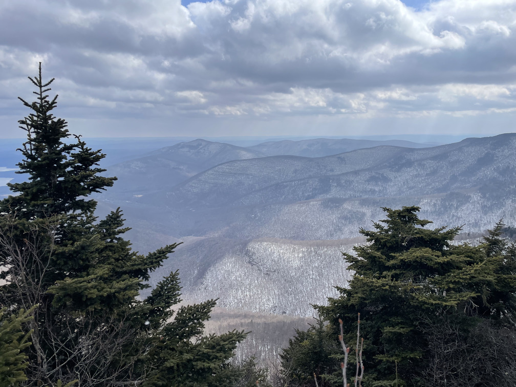
We passed the “pregnant tree” and were soon at the summit of Friday with its spectacular and unexpected viewpoint.
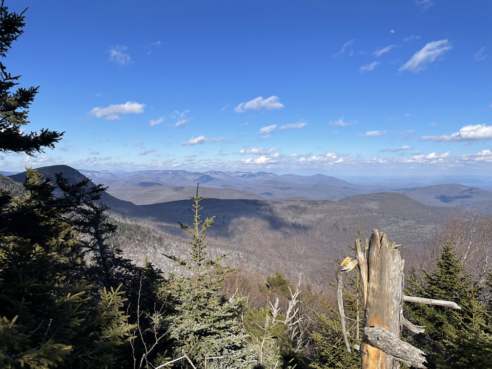
Why is it called “Friday”? Most of the other mountain names in the Catskills are clear (“Balsam Cap”, “Rocky”, “Twin”, “Sugarloaf”) but this one isn’t. Jim Bouton on the Catskills group said it was known as “middle ridge” before they realized it was 3500ft, but he didn’t know why it was named Friday.
In our haste to get away from the Rip Van Winkle group, we went the wrong direction from the summit canister and soon found ourselves in dense woods with no tracks. We doubled back and found a path with some footprints along the summit ridge. This section was snowier and less trafficked, and we hemmed and hawed about switching to snowshoes.
We ran into two hikers here. I was 98% sure one of them was Sarah Zheng, whose AllTrails hikes I’ve frequently drawn inspiration from. To confirm, I asked whether they were working on any lists. No, they’d done them all already. Her only project was hiking The Nine every month. She was currently on month 36. Well that confirmed it, nobody else is doing that! Sarah was in spikes and told us not to follow their tracks too closely, they’d gotten lost around Dink. (Looking at her track later, wow!) She also told us to go to the right of the Cornell crack, which would prove helpful later.
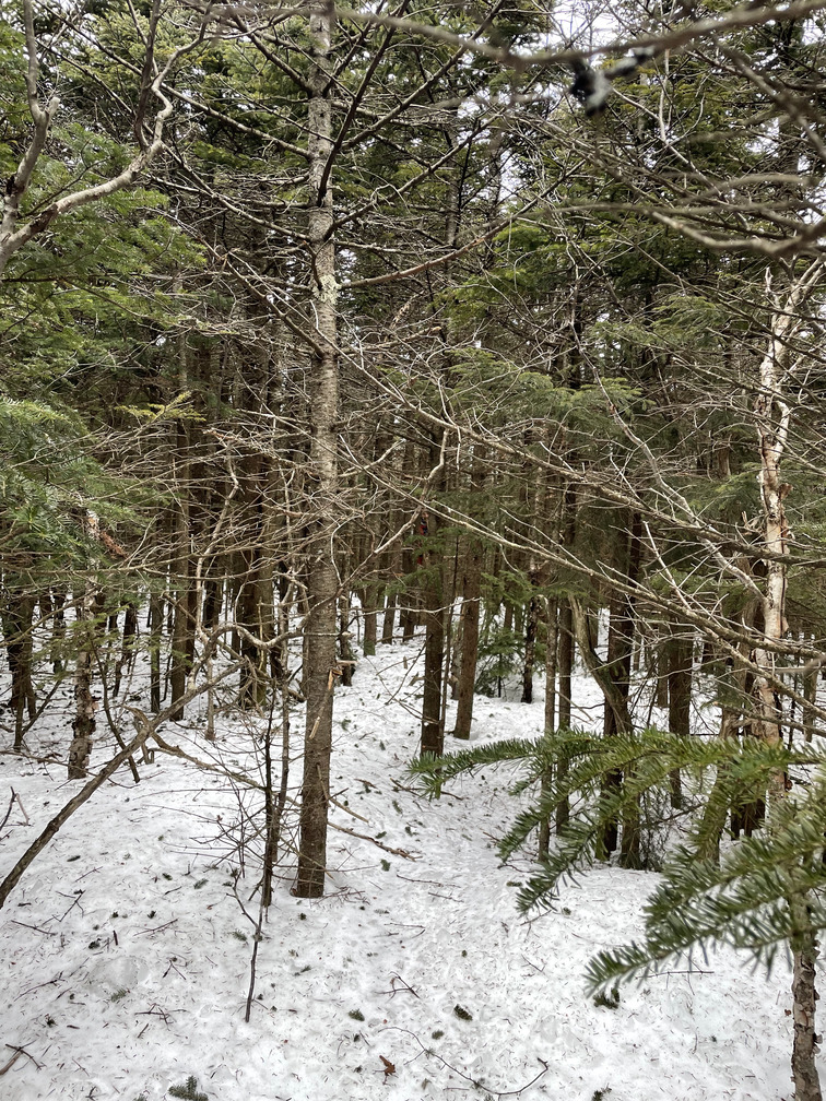
The section of woods between Friday and Cornell is dense and difficult to navigate. We occasionally found tracks but would usually lose them again soon after. We did eventually switch to snowshoes here. This gave us more support on bare snow, but also meant that they didn’t get caught on trees as I ducked between them. This was the first bushwhack I did in the Catskills and I think it remains the hardest.
We eventually wound up below some cliffs near Cornell and had to navigate back around to the blazed trail. I can only imagine doing this without GPS! The Cornell trail was very icy and had some ledges. We switched back to spikes. We took a break for lunch near the Cornell summit.
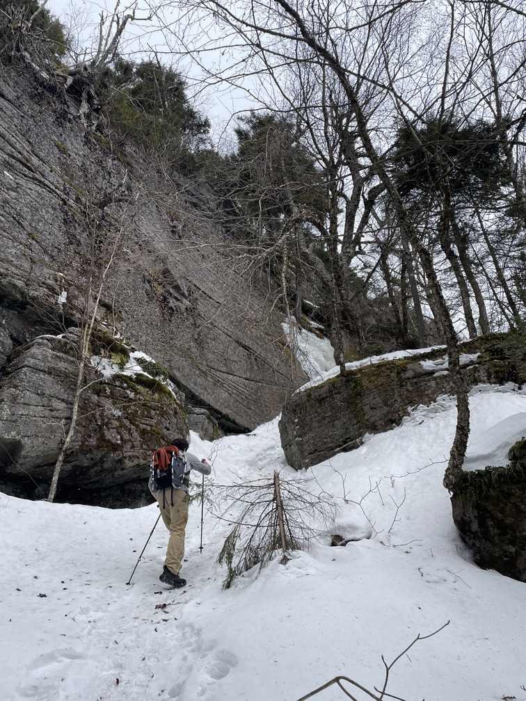
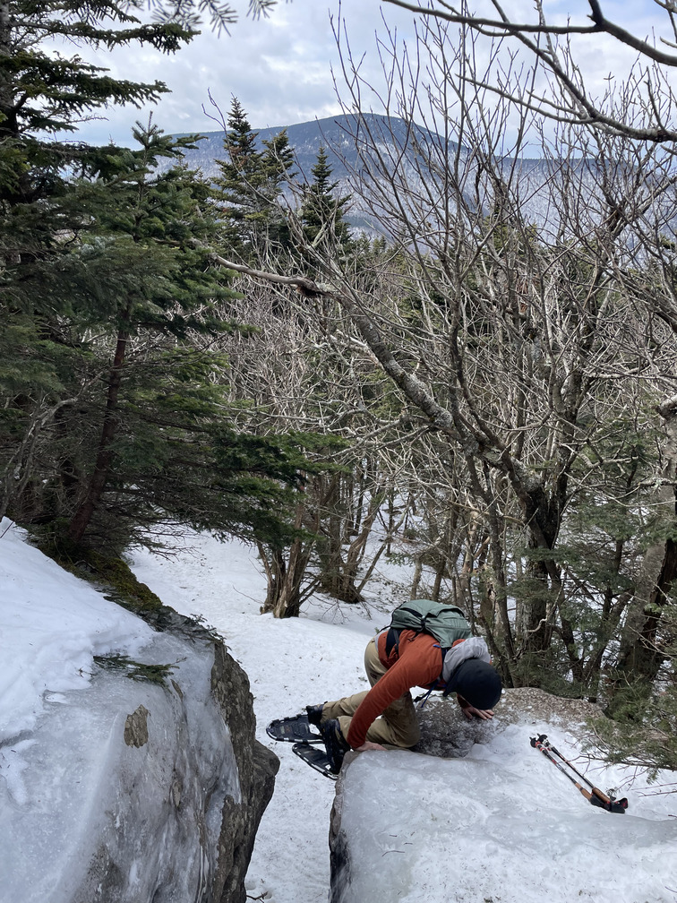
Soon we came to the final obstacle to my Winter 3500 peaks: the Cornell Crack! It was completely iced over and basically impassable.

I’ve never had trouble navigating this feature, but it was a completely different situation in the winter. I thought about trying it on the way down but backed off. I thought about it again on the way back up, but backed off both times. Maybe if I’d had an ice axe. It’s just tough to really commit to a spike foot hold with such high consequences.
So how to go around the crack? Did Sarah mean “to the right” on your way up or on your way down? We figured on your way up since that’s the direction she was coming from. And sure enough, John found a descent that was still icy but had a helpful tree for grip.
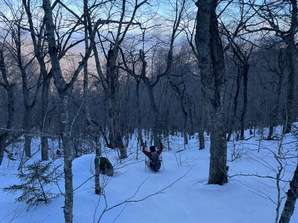
After a few more ledges, we were at the spectacular Wittenberg summit viewpoint. I’d completed my winter peaks!
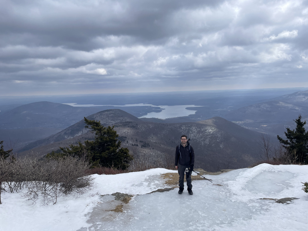
We stayed here for a few minutes and enjoyed the view. John noticed that you could see the old logging roads below Friday.
We missed the turnoff from the red Cornell trail into the woods and improvised in our snowshoes again. We maybe did a little bit better this time? Around Dink, we recovered our tracks from the morning and followed them back to Friday.
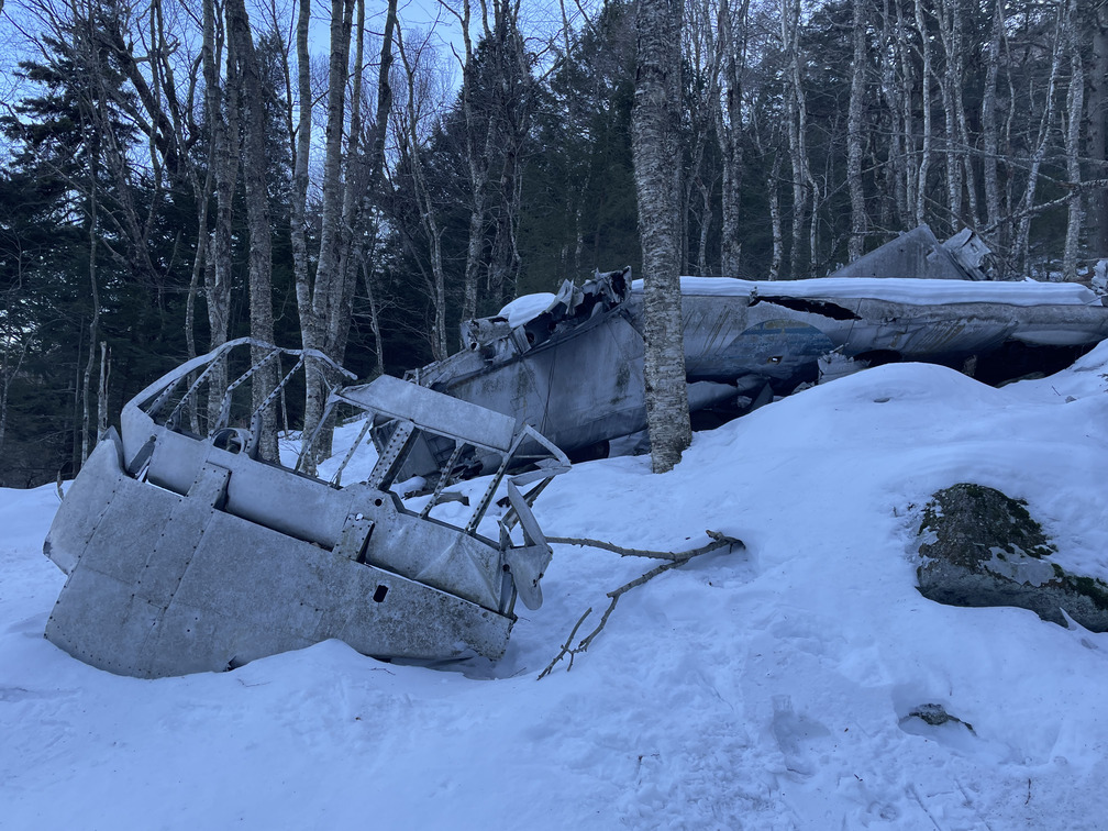
The Rip Van Winkle crew told us that they’d planned to visit the B-25 wreck by snowshoeing straight down from the pregnant tree. We hoped to find their tracks on our way back, but there were none. We improvised and were mostly fine in our spikes. The snow was crustier here and usually enough to support our weight.
After dropping about 500 feet, we found the crash. It’s pretty hard to miss if you’re in the right spot. It is large and there are many pieces. You can read more about the crash on the wreckchasing site, but the gist is that they were on their way to Stewart air base in 1948 when they made a navigation error due to poor conditions, mistaking the Ashokan Reservoir for the Hudson. Three people died.
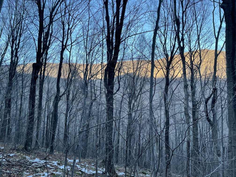
We saw the shadow of Friday Mountain across the valley during the descent. Seeing your own mountain’s shadow is always dramatic, but also a sign that you need to hurry up to get to the car before sunset.
We met up with Alex and Sam for a celebratory dinner at Ollie’s. Sam arranged the cars so that neither John nor I had to drive, which was much appreciated.
I submitted my tally sheet in the evening. Hopefully I’ll get my winter number soon!